You are here: Home > Network List > TA - USArray Transportable Network (new EarthScope stations) Stations List
> Station R33M Jennings River, BC, CAN > Earthquake Result Viewer
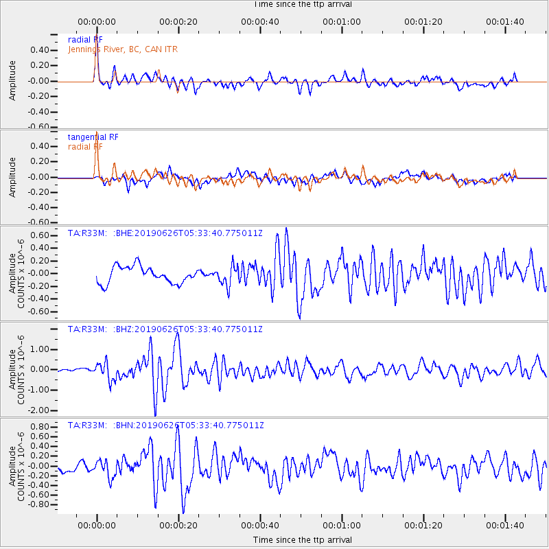
R33M Jennings River, BC, CAN - Earthquake Result Viewer
*The percent match for this event was below the threshold and hence no stack was calculated.
| Earthquake location: |
Panama-Costa Rica Border Region |
| Earthquake latitude/longitude: |
8.4/-82.8 |
| Earthquake time(UTC): |
2019/06/26 (177) 05:23:48 GMT |
| Earthquake Depth: |
10 km |
| Earthquake Magnitude: |
6.3 Mww |
| Earthquake Catalog/Contributor: |
NEIC PDE/us |
|
| Network: |
TA USArray Transportable Network (new EarthScope stations) |
| Station: |
R33M Jennings River, BC, CAN |
| Lat/Lon: |
59.39 N/130.97 W |
| Elevation: |
1437 m |
|
| Distance: |
62.4 deg |
| Az: |
334.524 deg |
| Baz: |
123.728 deg |
| Ray Param: |
$rayparam |
*The percent match for this event was below the threshold and hence was not used in the summary stack. |
|
| Radial Match: |
79.56309 % |
| Radial Bump: |
400 |
| Transverse Match: |
71.33004 % |
| Transverse Bump: |
400 |
| SOD ConfigId: |
18369291 |
| Insert Time: |
2019-07-10 05:36:32.473 +0000 |
| GWidth: |
2.5 |
| Max Bumps: |
400 |
| Tol: |
0.001 |
|
Signal To Noise
| Channel | StoN | STA | LTA |
| TA:R33M: :BHZ:20190626T05:33:40.775011Z | 5.6628976 | 4.3861766E-7 | 7.745464E-8 |
| TA:R33M: :BHN:20190626T05:33:40.775011Z | 1.6592498 | 1.7894966E-7 | 1.0784974E-7 |
| TA:R33M: :BHE:20190626T05:33:40.775011Z | 1.2006963 | 1.5498404E-7 | 1.2907846E-7 |
| Arrivals |
| Ps | |
| PpPs | |
| PsPs/PpSs | |


