You are here: Home > Network List > TA - USArray Transportable Network (new EarthScope stations) Stations List
> Station C21A Desert Coulee Ranch, Glasgow, MT, USA > Earthquake Result Viewer
C21A Desert Coulee Ranch, Glasgow, MT, USA - Earthquake Result Viewer

| Earthquake location: |
Northern Mid-Atlantic Ridge |
| Earthquake latitude/longitude: |
23.9/-46.1 |
| Earthquake time(UTC): |
2009/06/06 (157) 20:33:28 GMT |
| Earthquake Depth: |
14 km |
| Earthquake Magnitude: |
6.0 MB, 5.7 MS, 6.0 MW, 6.0 MW |
| Earthquake Catalog/Contributor: |
WHDF/NEIC |
|
| Network: |
TA USArray Transportable Network (new EarthScope stations) |
| Station: |
C21A Desert Coulee Ranch, Glasgow, MT, USA |
| Lat/Lon: |
47.83 N/107.10 W |
| Elevation: |
804 m |
|
| Distance: |
53.4 deg |
| Az: |
312.761 deg |
| Baz: |
94.068 deg |
| Ray Param: |
0.066124626 |
| Estimated Moho Depth: |
68.5 km |
| Estimated Crust Vp/Vs: |
1.60 |
| Assumed Crust Vp: |
6.438 km/s |
| Estimated Crust Vs: |
4.023 km/s |
| Estimated Crust Poisson's Ratio: |
0.18 |
|
| Radial Match: |
84.85779 % |
| Radial Bump: |
303 |
| Transverse Match: |
75.19818 % |
| Transverse Bump: |
400 |
| SOD ConfigId: |
2648 |
| Insert Time: |
2010-03-07 00:49:58.838 +0000 |
| GWidth: |
2.5 |
| Max Bumps: |
400 |
| Tol: |
0.001 |
|
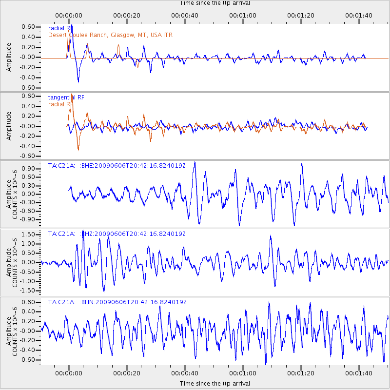
Signal To Noise
| Channel | StoN | STA | LTA |
| TA:C21A: :BHZ:20090606T20:42:16.824019Z | 10.332745 | 6.608886E-7 | 6.39606E-8 |
| TA:C21A: :BHN:20090606T20:42:16.824019Z | 1.9656065 | 1.7525618E-7 | 8.9161375E-8 |
| TA:C21A: :BHE:20090606T20:42:16.824019Z | 1.1394397 | 1.674754E-7 | 1.469805E-7 |
| Arrivals |
| Ps | 6.8 SECOND |
| PpPs | 26 SECOND |
| PsPs/PpSs | 33 SECOND |


