You are here: Home > Network List > US - United States National Seismic Network Stations List
> Station HAWA Hanford, Washington, USA > Earthquake Result Viewer
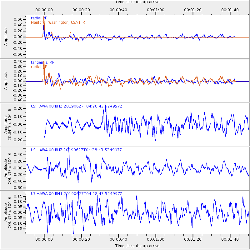
HAWA Hanford, Washington, USA - Earthquake Result Viewer
*The percent match for this event was below the threshold and hence no stack was calculated.
| Earthquake location: |
Komandorskiye Ostrova Region |
| Earthquake latitude/longitude: |
56.2/164.3 |
| Earthquake time(UTC): |
2019/06/27 (178) 04:20:48 GMT |
| Earthquake Depth: |
10 km |
| Earthquake Magnitude: |
5.7 Mww |
| Earthquake Catalog/Contributor: |
NEIC PDE/us |
|
| Network: |
US United States National Seismic Network |
| Station: |
HAWA Hanford, Washington, USA |
| Lat/Lon: |
46.39 N/119.53 W |
| Elevation: |
364 m |
|
| Distance: |
46.3 deg |
| Az: |
68.396 deg |
| Baz: |
311.337 deg |
| Ray Param: |
$rayparam |
*The percent match for this event was below the threshold and hence was not used in the summary stack. |
|
| Radial Match: |
68.26079 % |
| Radial Bump: |
400 |
| Transverse Match: |
54.595604 % |
| Transverse Bump: |
400 |
| SOD ConfigId: |
18369291 |
| Insert Time: |
2019-07-11 04:28:57.597 +0000 |
| GWidth: |
2.5 |
| Max Bumps: |
400 |
| Tol: |
0.001 |
|
Signal To Noise
| Channel | StoN | STA | LTA |
| US:HAWA:00:BHZ:20190627T04:28:43.524997Z | 2.321717 | 1.2728067E-7 | 5.4821783E-8 |
| US:HAWA:00:BH1:20190627T04:28:43.524997Z | 1.827755 | 7.9079065E-8 | 4.326568E-8 |
| US:HAWA:00:BH2:20190627T04:28:43.524997Z | 2.0186224 | 9.547443E-8 | 4.7296822E-8 |
| Arrivals |
| Ps | |
| PpPs | |
| PsPs/PpSs | |


