You are here: Home > Network List > TA - USArray Transportable Network (new EarthScope stations) Stations List
> Station C21A Desert Coulee Ranch, Glasgow, MT, USA > Earthquake Result Viewer
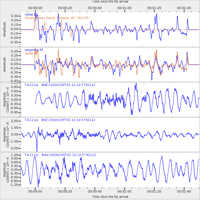
C21A Desert Coulee Ranch, Glasgow, MT, USA - Earthquake Result Viewer
*The percent match for this event was below the threshold and hence no stack was calculated.
| Earthquake location: |
Near Coast Of Northern Chile |
| Earthquake latitude/longitude: |
-28.0/-71.1 |
| Earthquake time(UTC): |
2009/02/06 (037) 02:58:35 GMT |
| Earthquake Depth: |
52 km |
| Earthquake Magnitude: |
5.5 MB |
| Earthquake Catalog/Contributor: |
WHDF/NEIC |
|
| Network: |
TA USArray Transportable Network (new EarthScope stations) |
| Station: |
C21A Desert Coulee Ranch, Glasgow, MT, USA |
| Lat/Lon: |
47.83 N/107.10 W |
| Elevation: |
804 m |
|
| Distance: |
82.1 deg |
| Az: |
336.435 deg |
| Baz: |
148.354 deg |
| Ray Param: |
$rayparam |
*The percent match for this event was below the threshold and hence was not used in the summary stack. |
|
| Radial Match: |
55.82503 % |
| Radial Bump: |
327 |
| Transverse Match: |
56.071743 % |
| Transverse Bump: |
400 |
| SOD ConfigId: |
2658 |
| Insert Time: |
2010-03-07 00:51:22.905 +0000 |
| GWidth: |
2.5 |
| Max Bumps: |
400 |
| Tol: |
0.001 |
|
Signal To Noise
| Channel | StoN | STA | LTA |
| TA:C21A: :BHZ:20090206T03:10:19.574011Z | 2.6418397 | 7.120331E-7 | 2.6952168E-7 |
| TA:C21A: :BHN:20090206T03:10:19.574011Z | 1.1362016 | 7.4096624E-7 | 6.521433E-7 |
| TA:C21A: :BHE:20090206T03:10:19.574011Z | 1.2742243 | 4.2323157E-7 | 3.321484E-7 |
| Arrivals |
| Ps | |
| PpPs | |
| PsPs/PpSs | |


