You are here: Home > Network List > PF - Volcanologic Network of Piton de Fournaise-OVPF Stations List
> Station HIM cratere Himiltrude > Earthquake Result Viewer
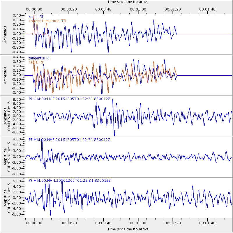
HIM cratere Himiltrude - Earthquake Result Viewer
*The percent match for this event was below the threshold and hence no stack was calculated.
| Earthquake location: |
Banda Sea |
| Earthquake latitude/longitude: |
-7.3/123.4 |
| Earthquake time(UTC): |
2016/12/05 (340) 01:13:04 GMT |
| Earthquake Depth: |
526 km |
| Earthquake Magnitude: |
6.3 Mww |
| Earthquake Catalog/Contributor: |
NEIC PDE/us |
|
| Network: |
PF Volcanologic Network of Piton de Fournaise-OVPF |
| Station: |
HIM cratere Himiltrude |
| Lat/Lon: |
21.21 S/55.72 E |
| Elevation: |
1958 m |
|
| Distance: |
66.6 deg |
| Az: |
250.128 deg |
| Baz: |
88.902 deg |
| Ray Param: |
$rayparam |
*The percent match for this event was below the threshold and hence was not used in the summary stack. |
|
| Radial Match: |
47.070023 % |
| Radial Bump: |
334 |
| Transverse Match: |
61.116417 % |
| Transverse Bump: |
400 |
| SOD ConfigId: |
1894071 |
| Insert Time: |
2016-12-19 01:15:10.690 +0000 |
| GWidth: |
2.5 |
| Max Bumps: |
400 |
| Tol: |
0.001 |
|
Signal To Noise
| Channel | StoN | STA | LTA |
| PF:HIM:00:HHZ:20161205T01:22:31.830012Z | 4.4682407 | 2.9229711E-6 | 6.54166E-7 |
| PF:HIM:00:HHN:20161205T01:22:31.830012Z | 1.690096 | 1.5280174E-6 | 9.0410094E-7 |
| PF:HIM:00:HHE:20161205T01:22:31.830012Z | 1.4099901 | 1.998006E-6 | 1.4170355E-6 |
| Arrivals |
| Ps | |
| PpPs | |
| PsPs/PpSs | |


