You are here: Home > Network List > TA - USArray Transportable Network (new EarthScope stations) Stations List
> Station A24A Westby, ND, USA > Earthquake Result Viewer
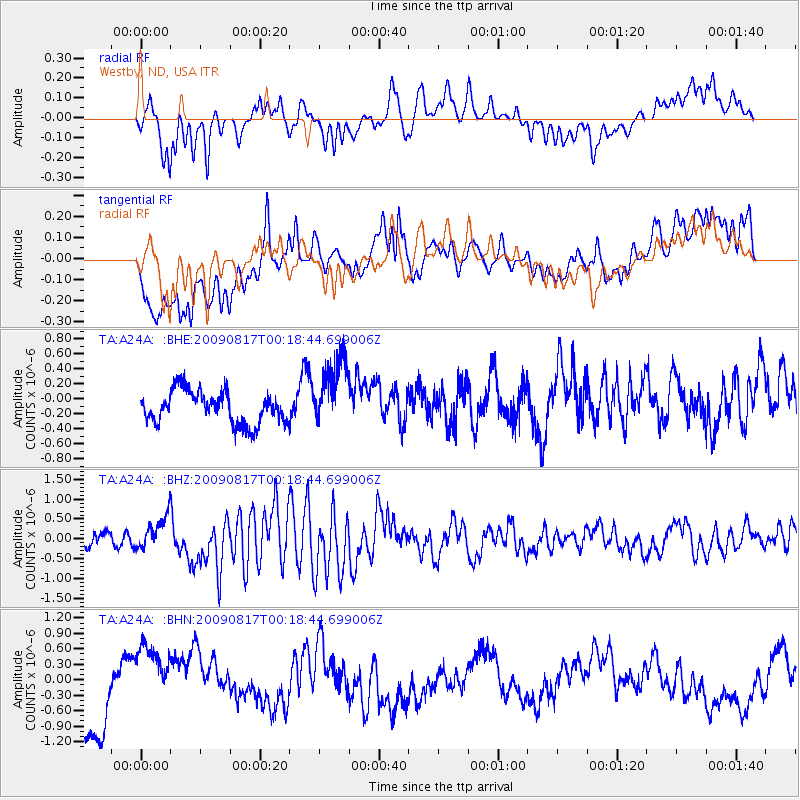
A24A Westby, ND, USA - Earthquake Result Viewer
*The percent match for this event was below the threshold and hence no stack was calculated.
| Earthquake location: |
Southwestern Ryukyu Isl., Japan |
| Earthquake latitude/longitude: |
23.5/123.5 |
| Earthquake time(UTC): |
2009/08/17 (229) 00:05:49 GMT |
| Earthquake Depth: |
20 km |
| Earthquake Magnitude: |
6.2 MB, 6.6 MS, 6.7 MW, 6.6 MW |
| Earthquake Catalog/Contributor: |
WHDF/NEIC |
|
| Network: |
TA USArray Transportable Network (new EarthScope stations) |
| Station: |
A24A Westby, ND, USA |
| Lat/Lon: |
48.92 N/104.00 W |
| Elevation: |
677 m |
|
| Distance: |
96.4 deg |
| Az: |
29.296 deg |
| Baz: |
317.073 deg |
| Ray Param: |
$rayparam |
*The percent match for this event was below the threshold and hence was not used in the summary stack. |
|
| Radial Match: |
57.15471 % |
| Radial Bump: |
400 |
| Transverse Match: |
47.67142 % |
| Transverse Bump: |
400 |
| SOD ConfigId: |
2622 |
| Insert Time: |
2010-03-07 00:52:02.002 +0000 |
| GWidth: |
2.5 |
| Max Bumps: |
400 |
| Tol: |
0.001 |
|
Signal To Noise
| Channel | StoN | STA | LTA |
| TA:A24A: :BHZ:20090817T00:18:44.699006Z | 3.0298798 | 4.2192E-7 | 1.3925305E-7 |
| TA:A24A: :BHN:20090817T00:18:44.699006Z | 0.9575502 | 6.778677E-7 | 7.0791873E-7 |
| TA:A24A: :BHE:20090817T00:18:44.699006Z | 2.195577 | 4.6497215E-7 | 2.1177675E-7 |
| Arrivals |
| Ps | |
| PpPs | |
| PsPs/PpSs | |


