You are here: Home > Network List > TA - USArray Transportable Network (new EarthScope stations) Stations List
> Station A24A Westby, ND, USA > Earthquake Result Viewer
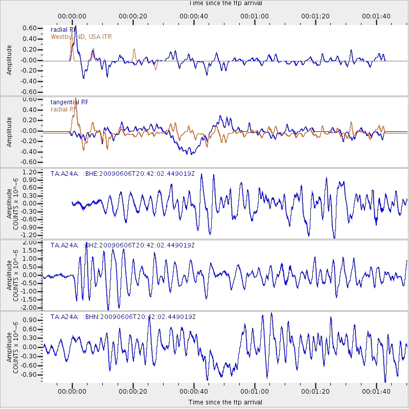
A24A Westby, ND, USA - Earthquake Result Viewer
*The percent match for this event was below the threshold and hence no stack was calculated.
| Earthquake location: |
Northern Mid-Atlantic Ridge |
| Earthquake latitude/longitude: |
23.9/-46.1 |
| Earthquake time(UTC): |
2009/06/06 (157) 20:33:28 GMT |
| Earthquake Depth: |
14 km |
| Earthquake Magnitude: |
6.0 MB, 5.7 MS, 6.0 MW, 6.0 MW |
| Earthquake Catalog/Contributor: |
WHDF/NEIC |
|
| Network: |
TA USArray Transportable Network (new EarthScope stations) |
| Station: |
A24A Westby, ND, USA |
| Lat/Lon: |
48.92 N/104.00 W |
| Elevation: |
677 m |
|
| Distance: |
51.4 deg |
| Az: |
314.4 deg |
| Baz: |
97.374 deg |
| Ray Param: |
$rayparam |
*The percent match for this event was below the threshold and hence was not used in the summary stack. |
|
| Radial Match: |
78.294846 % |
| Radial Bump: |
400 |
| Transverse Match: |
59.815285 % |
| Transverse Bump: |
400 |
| SOD ConfigId: |
2648 |
| Insert Time: |
2010-03-07 00:52:31.193 +0000 |
| GWidth: |
2.5 |
| Max Bumps: |
400 |
| Tol: |
0.001 |
|
Signal To Noise
| Channel | StoN | STA | LTA |
| TA:A24A: :BHZ:20090606T20:42:02.449019Z | 11.65187 | 9.117357E-7 | 7.8248014E-8 |
| TA:A24A: :BHN:20090606T20:42:02.449019Z | 1.0553973 | 2.5915114E-7 | 2.4554842E-7 |
| TA:A24A: :BHE:20090606T20:42:02.449019Z | 1.5185938 | 3.46418E-7 | 2.2811761E-7 |
| Arrivals |
| Ps | |
| PpPs | |
| PsPs/PpSs | |


