You are here: Home > Network List > TA - USArray Transportable Network (new EarthScope stations) Stations List
> Station G16K Koyuk River, AK, USA > Earthquake Result Viewer
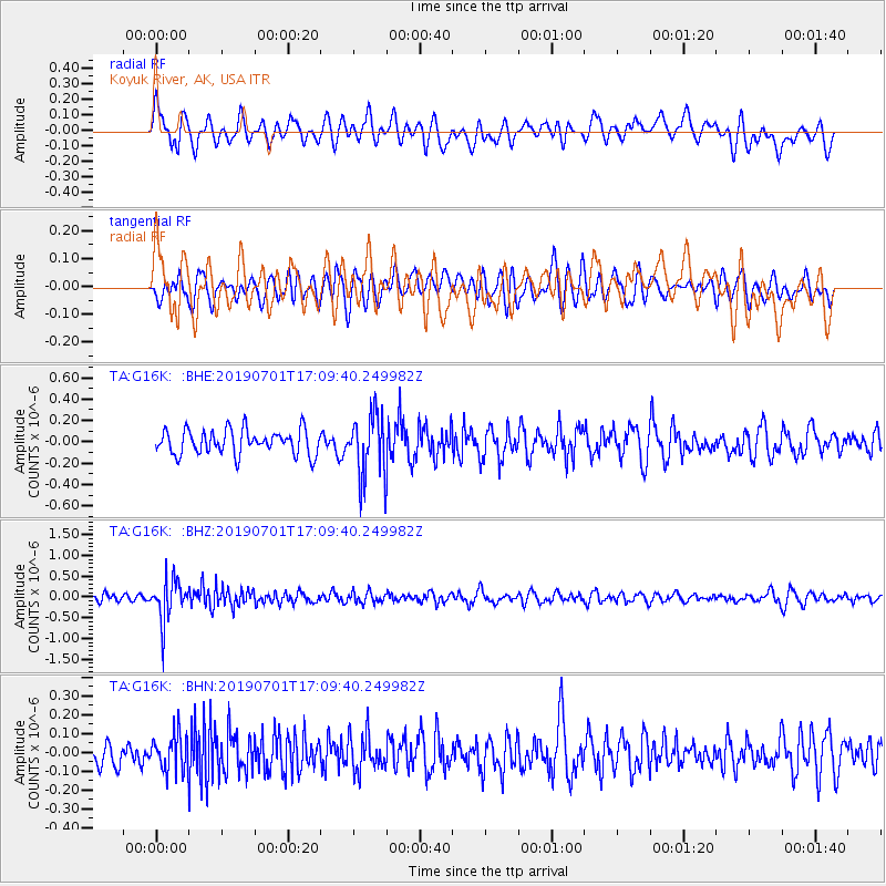
G16K Koyuk River, AK, USA - Earthquake Result Viewer
*The percent match for this event was below the threshold and hence no stack was calculated.
| Earthquake location: |
Mindanao, Philippines |
| Earthquake latitude/longitude: |
9.1/124.2 |
| Earthquake time(UTC): |
2019/07/01 (182) 16:59:25 GMT |
| Earthquake Depth: |
538 km |
| Earthquake Magnitude: |
5.9 Mww |
| Earthquake Catalog/Contributor: |
NEIC PDE/us |
|
| Network: |
TA USArray Transportable Network (new EarthScope stations) |
| Station: |
G16K Koyuk River, AK, USA |
| Lat/Lon: |
65.39 N/162.35 W |
| Elevation: |
169 m |
|
| Distance: |
74.9 deg |
| Az: |
24.567 deg |
| Baz: |
258.677 deg |
| Ray Param: |
$rayparam |
*The percent match for this event was below the threshold and hence was not used in the summary stack. |
|
| Radial Match: |
46.006176 % |
| Radial Bump: |
400 |
| Transverse Match: |
47.849865 % |
| Transverse Bump: |
400 |
| SOD ConfigId: |
18369291 |
| Insert Time: |
2019-07-15 17:05:06.989 +0000 |
| GWidth: |
2.5 |
| Max Bumps: |
400 |
| Tol: |
0.001 |
|
Signal To Noise
| Channel | StoN | STA | LTA |
| TA:G16K: :BHZ:20190701T17:09:40.249982Z | 5.1891646 | 4.927285E-7 | 9.495333E-8 |
| TA:G16K: :BHN:20190701T17:09:40.249982Z | 1.5865432 | 9.891354E-8 | 6.234532E-8 |
| TA:G16K: :BHE:20190701T17:09:40.249982Z | 2.5486908 | 2.9379487E-7 | 1.15272854E-7 |
| Arrivals |
| Ps | |
| PpPs | |
| PsPs/PpSs | |


