You are here: Home > Network List > TA - USArray Transportable Network (new EarthScope stations) Stations List
> Station B23A Brockton, MT, USA > Earthquake Result Viewer
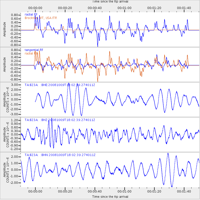
B23A Brockton, MT, USA - Earthquake Result Viewer
*The percent match for this event was below the threshold and hence no stack was calculated.
| Earthquake location: |
Tonga Islands |
| Earthquake latitude/longitude: |
-21.0/-174.4 |
| Earthquake time(UTC): |
2008/10/09 (283) 17:49:58 GMT |
| Earthquake Depth: |
10 km |
| Earthquake Magnitude: |
5.8 MB, 5.6 MS, 5.9 MW, 5.9 MW |
| Earthquake Catalog/Contributor: |
WHDF/NEIC |
|
| Network: |
TA USArray Transportable Network (new EarthScope stations) |
| Station: |
B23A Brockton, MT, USA |
| Lat/Lon: |
48.46 N/104.99 W |
| Elevation: |
716 m |
|
| Distance: |
92.7 deg |
| Az: |
38.598 deg |
| Baz: |
241.12 deg |
| Ray Param: |
$rayparam |
*The percent match for this event was below the threshold and hence was not used in the summary stack. |
|
| Radial Match: |
58.606777 % |
| Radial Bump: |
276 |
| Transverse Match: |
17.18695 % |
| Transverse Bump: |
182 |
| SOD ConfigId: |
2556 |
| Insert Time: |
2010-03-07 00:53:42.217 +0000 |
| GWidth: |
2.5 |
| Max Bumps: |
400 |
| Tol: |
0.001 |
|
Signal To Noise
| Channel | StoN | STA | LTA |
| TA:B23A: :BHZ:20081009T18:02:39.274011Z | 2.3073866 | 4.1523015E-7 | 1.799569E-7 |
| TA:B23A: :BHN:20081009T18:02:39.274011Z | 0.8420412 | 7.7154203E-7 | 9.1627584E-7 |
| TA:B23A: :BHE:20081009T18:02:39.274011Z | 1.5535781 | 1.996713E-6 | 1.285235E-6 |
| Arrivals |
| Ps | |
| PpPs | |
| PsPs/PpSs | |


