You are here: Home > Network List > TA - USArray Transportable Network (new EarthScope stations) Stations List
> Station B23A Brockton, MT, USA > Earthquake Result Viewer
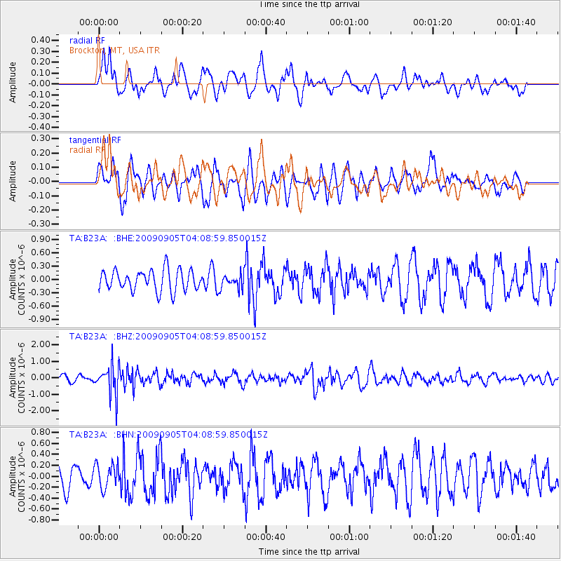
B23A Brockton, MT, USA - Earthquake Result Viewer
*The percent match for this event was below the threshold and hence no stack was calculated.
| Earthquake location: |
Southern Peru |
| Earthquake latitude/longitude: |
-15.1/-70.2 |
| Earthquake time(UTC): |
2009/09/05 (248) 03:58:39 GMT |
| Earthquake Depth: |
210 km |
| Earthquake Magnitude: |
5.8 MW, 5.2 MB, 5.8 MW |
| Earthquake Catalog/Contributor: |
WHDF/NEIC |
|
| Network: |
TA USArray Transportable Network (new EarthScope stations) |
| Station: |
B23A Brockton, MT, USA |
| Lat/Lon: |
48.46 N/104.99 W |
| Elevation: |
716 m |
|
| Distance: |
70.4 deg |
| Az: |
336.263 deg |
| Baz: |
144.26 deg |
| Ray Param: |
$rayparam |
*The percent match for this event was below the threshold and hence was not used in the summary stack. |
|
| Radial Match: |
50.110867 % |
| Radial Bump: |
400 |
| Transverse Match: |
43.53594 % |
| Transverse Bump: |
400 |
| SOD ConfigId: |
2622 |
| Insert Time: |
2010-03-07 00:53:55.384 +0000 |
| GWidth: |
2.5 |
| Max Bumps: |
400 |
| Tol: |
0.001 |
|
Signal To Noise
| Channel | StoN | STA | LTA |
| TA:B23A: :BHZ:20090905T04:08:59.850015Z | 5.0649476 | 8.928923E-7 | 1.7628855E-7 |
| TA:B23A: :BHN:20090905T04:08:59.850015Z | 0.7454049 | 2.221999E-7 | 2.9809289E-7 |
| TA:B23A: :BHE:20090905T04:08:59.850015Z | 0.6602145 | 1.5242874E-7 | 2.3087759E-7 |
| Arrivals |
| Ps | |
| PpPs | |
| PsPs/PpSs | |


