You are here: Home > Network List > TA - USArray Transportable Network (new EarthScope stations) Stations List
> Station B23A Brockton, MT, USA > Earthquake Result Viewer
B23A Brockton, MT, USA - Earthquake Result Viewer
*The percent match for this event was below the threshold and hence no stack was calculated.
| Earthquake location: |
Easter Island Region |
| Earthquake latitude/longitude: |
-29.9/-111.8 |
| Earthquake time(UTC): |
2009/09/10 (253) 19:46:03 GMT |
| Earthquake Depth: |
10 km |
| Earthquake Magnitude: |
5.5 MW, 5.4 MB |
| Earthquake Catalog/Contributor: |
WHDF/NEIC |
|
| Network: |
TA USArray Transportable Network (new EarthScope stations) |
| Station: |
B23A Brockton, MT, USA |
| Lat/Lon: |
48.46 N/104.99 W |
| Elevation: |
716 m |
|
| Distance: |
78.3 deg |
| Az: |
4.639 deg |
| Baz: |
186.055 deg |
| Ray Param: |
$rayparam |
*The percent match for this event was below the threshold and hence was not used in the summary stack. |
|
| Radial Match: |
46.305897 % |
| Radial Bump: |
400 |
| Transverse Match: |
47.236526 % |
| Transverse Bump: |
368 |
| SOD ConfigId: |
2622 |
| Insert Time: |
2010-03-07 00:54:00.181 +0000 |
| GWidth: |
2.5 |
| Max Bumps: |
400 |
| Tol: |
0.001 |
|
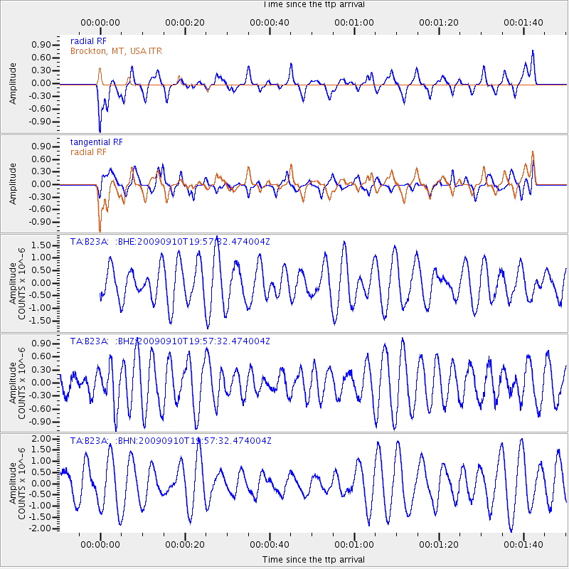
Signal To Noise
| Channel | StoN | STA | LTA |
| TA:B23A: :BHZ:20090910T19:57:32.474004Z | 1.1641234 | 4.5845502E-7 | 3.9381993E-7 |
| TA:B23A: :BHN:20090910T19:57:32.474004Z | 2.2592018 | 1.1755474E-6 | 5.203375E-7 |
| TA:B23A: :BHE:20090910T19:57:32.474004Z | 1.0966635 | 7.757218E-7 | 7.073472E-7 |
| Arrivals |
| Ps | |
| PpPs | |
| PsPs/PpSs | |


