You are here: Home > Network List > TA - USArray Transportable Network (new EarthScope stations) Stations List
> Station B23A Brockton, MT, USA > Earthquake Result Viewer
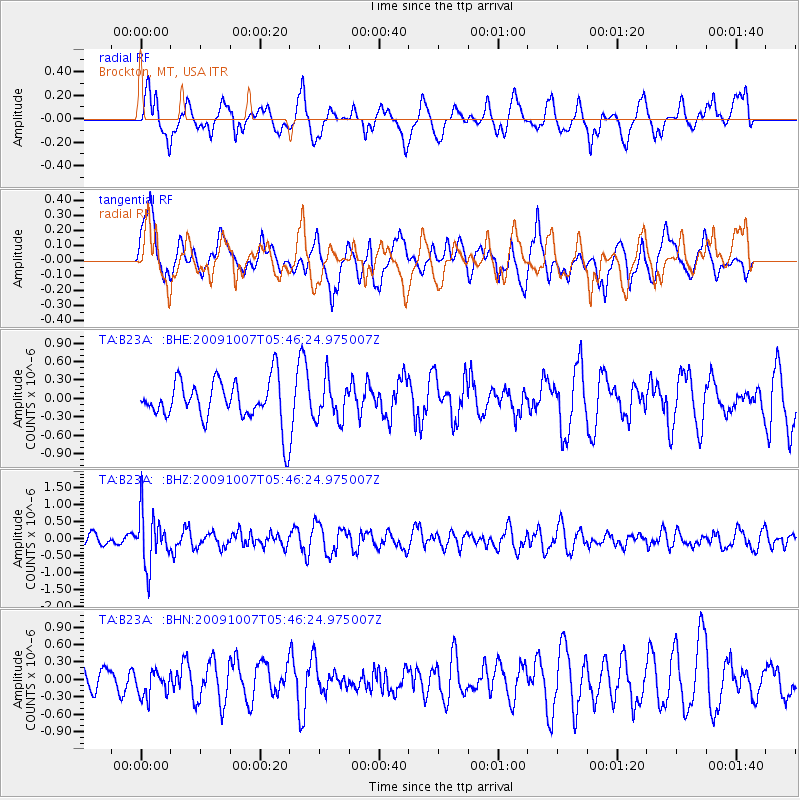
B23A Brockton, MT, USA - Earthquake Result Viewer
*The percent match for this event was below the threshold and hence no stack was calculated.
| Earthquake location: |
Rat Islands, Aleutian Islands |
| Earthquake latitude/longitude: |
52.2/178.1 |
| Earthquake time(UTC): |
2009/10/07 (280) 05:38:37 GMT |
| Earthquake Depth: |
138 km |
| Earthquake Magnitude: |
5.6 MB, 5.6 MW, 5.6 MW |
| Earthquake Catalog/Contributor: |
WHDF/NEIC |
|
| Network: |
TA USArray Transportable Network (new EarthScope stations) |
| Station: |
B23A Brockton, MT, USA |
| Lat/Lon: |
48.46 N/104.99 W |
| Elevation: |
716 m |
|
| Distance: |
47.1 deg |
| Az: |
62.227 deg |
| Baz: |
305.017 deg |
| Ray Param: |
$rayparam |
*The percent match for this event was below the threshold and hence was not used in the summary stack. |
|
| Radial Match: |
47.3493 % |
| Radial Bump: |
397 |
| Transverse Match: |
58.15563 % |
| Transverse Bump: |
400 |
| SOD ConfigId: |
2622 |
| Insert Time: |
2010-03-07 00:54:07.047 +0000 |
| GWidth: |
2.5 |
| Max Bumps: |
400 |
| Tol: |
0.001 |
|
Signal To Noise
| Channel | StoN | STA | LTA |
| TA:B23A: :BHZ:20091007T05:46:24.975007Z | 3.775285 | 7.6994627E-7 | 2.0394387E-7 |
| TA:B23A: :BHN:20091007T05:46:24.975007Z | 0.5259287 | 2.2066583E-7 | 4.195737E-7 |
| TA:B23A: :BHE:20091007T05:46:24.975007Z | 0.92780274 | 3.160156E-7 | 3.4060642E-7 |
| Arrivals |
| Ps | |
| PpPs | |
| PsPs/PpSs | |


