You are here: Home > Network List > TA - USArray Transportable Network (new EarthScope stations) Stations List
> Station B23A Brockton, MT, USA > Earthquake Result Viewer
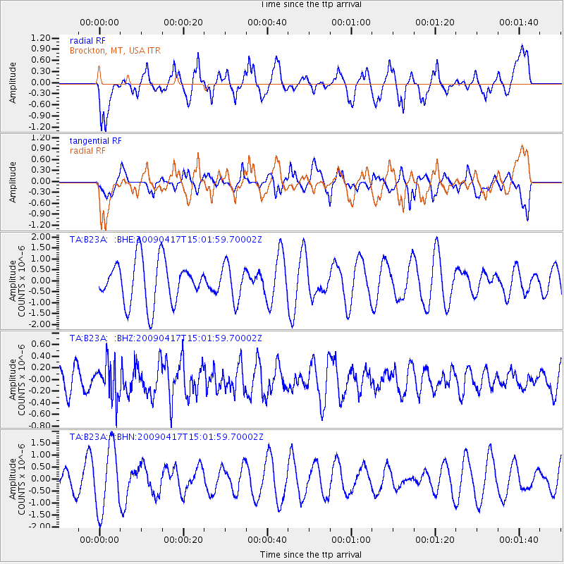
B23A Brockton, MT, USA - Earthquake Result Viewer
*The percent match for this event was below the threshold and hence no stack was calculated.
| Earthquake location: |
Kuril Islands |
| Earthquake latitude/longitude: |
46.2/151.7 |
| Earthquake time(UTC): |
2009/04/17 (107) 14:51:58 GMT |
| Earthquake Depth: |
49 km |
| Earthquake Magnitude: |
5.5 MB, 5.0 MS, 5.7 MW, 5.6 MW |
| Earthquake Catalog/Contributor: |
WHDF/NEIC |
|
| Network: |
TA USArray Transportable Network (new EarthScope stations) |
| Station: |
B23A Brockton, MT, USA |
| Lat/Lon: |
48.46 N/104.99 W |
| Elevation: |
716 m |
|
| Distance: |
64.5 deg |
| Az: |
45.848 deg |
| Baz: |
311.481 deg |
| Ray Param: |
$rayparam |
*The percent match for this event was below the threshold and hence was not used in the summary stack. |
|
| Radial Match: |
55.842907 % |
| Radial Bump: |
400 |
| Transverse Match: |
46.974045 % |
| Transverse Bump: |
381 |
| SOD ConfigId: |
2658 |
| Insert Time: |
2010-03-07 00:54:17.267 +0000 |
| GWidth: |
2.5 |
| Max Bumps: |
400 |
| Tol: |
0.001 |
|
Signal To Noise
| Channel | StoN | STA | LTA |
| TA:B23A: :BHZ:20090417T15:01:59.70002Z | 1.4026623 | 3.0990847E-7 | 2.2094305E-7 |
| TA:B23A: :BHN:20090417T15:01:59.70002Z | 5.6786 | 1.3892442E-6 | 2.4464555E-7 |
| TA:B23A: :BHE:20090417T15:01:59.70002Z | 0.84845597 | 8.397198E-7 | 9.897035E-7 |
| Arrivals |
| Ps | |
| PpPs | |
| PsPs/PpSs | |


