You are here: Home > Network List > TA - USArray Transportable Network (new EarthScope stations) Stations List
> Station B23A Brockton, MT, USA > Earthquake Result Viewer
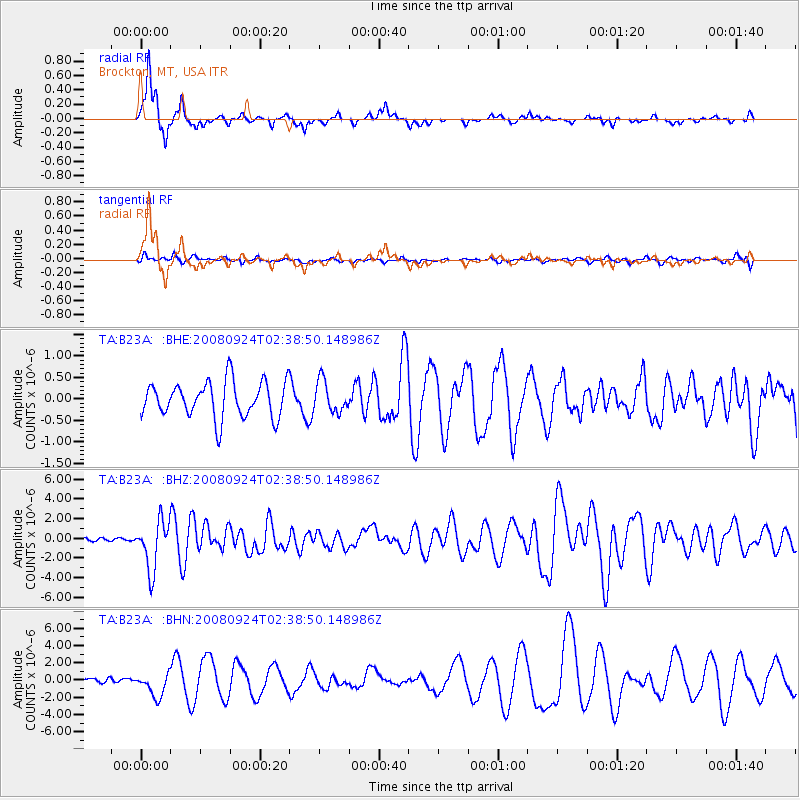
B23A Brockton, MT, USA - Earthquake Result Viewer
*The percent match for this event was below the threshold and hence no stack was calculated.
| Earthquake location: |
Off Coast Of Jalisco, Mexico |
| Earthquake latitude/longitude: |
17.6/-105.5 |
| Earthquake time(UTC): |
2008/09/24 (268) 02:33:05 GMT |
| Earthquake Depth: |
10 km |
| Earthquake Magnitude: |
5.7 MB, 6.2 MS, 6.4 MW, 6.4 MW |
| Earthquake Catalog/Contributor: |
WHDF/NEIC |
|
| Network: |
TA USArray Transportable Network (new EarthScope stations) |
| Station: |
B23A Brockton, MT, USA |
| Lat/Lon: |
48.46 N/104.99 W |
| Elevation: |
716 m |
|
| Distance: |
30.8 deg |
| Az: |
0.662 deg |
| Baz: |
180.949 deg |
| Ray Param: |
$rayparam |
*The percent match for this event was below the threshold and hence was not used in the summary stack. |
|
| Radial Match: |
86.13278 % |
| Radial Bump: |
266 |
| Transverse Match: |
38.519157 % |
| Transverse Bump: |
376 |
| SOD ConfigId: |
2560 |
| Insert Time: |
2010-03-07 00:54:50.036 +0000 |
| GWidth: |
2.5 |
| Max Bumps: |
400 |
| Tol: |
0.001 |
|
Signal To Noise
| Channel | StoN | STA | LTA |
| TA:B23A: :BHZ:20080924T02:38:50.148986Z | 17.01984 | 2.4864573E-6 | 1.460917E-7 |
| TA:B23A: :BHN:20080924T02:38:50.148986Z | 7.670208 | 1.3703368E-6 | 1.7865705E-7 |
| TA:B23A: :BHE:20080924T02:38:50.148986Z | 0.87390983 | 3.610776E-7 | 4.1317492E-7 |
| Arrivals |
| Ps | |
| PpPs | |
| PsPs/PpSs | |


