You are here: Home > Network List > TA - USArray Transportable Network (new EarthScope stations) Stations List
> Station B18K Kokolik River, AK, USA > Earthquake Result Viewer
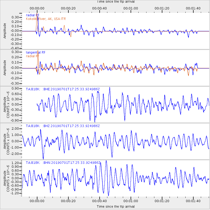
B18K Kokolik River, AK, USA - Earthquake Result Viewer
*The percent match for this event was below the threshold and hence no stack was calculated.
| Earthquake location: |
Vanuatu Islands |
| Earthquake latitude/longitude: |
-15.5/167.5 |
| Earthquake time(UTC): |
2019/07/01 (182) 17:13:29 GMT |
| Earthquake Depth: |
100 km |
| Earthquake Magnitude: |
6.0 Mww |
| Earthquake Catalog/Contributor: |
NEIC PDE/us |
|
| Network: |
TA USArray Transportable Network (new EarthScope stations) |
| Station: |
B18K Kokolik River, AK, USA |
| Lat/Lon: |
69.36 N/161.80 W |
| Elevation: |
222 m |
|
| Distance: |
87.3 deg |
| Az: |
10.433 deg |
| Baz: |
209.509 deg |
| Ray Param: |
$rayparam |
*The percent match for this event was below the threshold and hence was not used in the summary stack. |
|
| Radial Match: |
58.719044 % |
| Radial Bump: |
327 |
| Transverse Match: |
66.08794 % |
| Transverse Bump: |
356 |
| SOD ConfigId: |
18369291 |
| Insert Time: |
2019-07-15 17:19:28.067 +0000 |
| GWidth: |
2.5 |
| Max Bumps: |
400 |
| Tol: |
0.001 |
|
Signal To Noise
| Channel | StoN | STA | LTA |
| TA:B18K: :BHZ:20190701T17:25:33.924986Z | 1.8057659 | 1.1824857E-6 | 6.5483886E-7 |
| TA:B18K: :BHN:20190701T17:25:33.924986Z | 0.5949959 | 2.4400808E-7 | 4.1010043E-7 |
| TA:B18K: :BHE:20190701T17:25:33.924986Z | 1.1967783 | 3.485808E-7 | 2.91266E-7 |
| Arrivals |
| Ps | |
| PpPs | |
| PsPs/PpSs | |


