You are here: Home > Network List > TA - USArray Transportable Network (new EarthScope stations) Stations List
> Station M16K Timber Creek, AK, USA > Earthquake Result Viewer
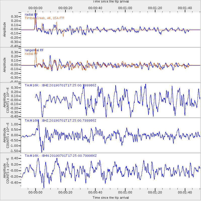
M16K Timber Creek, AK, USA - Earthquake Result Viewer
*The percent match for this event was below the threshold and hence no stack was calculated.
| Earthquake location: |
Vanuatu Islands |
| Earthquake latitude/longitude: |
-15.5/167.5 |
| Earthquake time(UTC): |
2019/07/01 (182) 17:13:29 GMT |
| Earthquake Depth: |
100 km |
| Earthquake Magnitude: |
6.0 Mww |
| Earthquake Catalog/Contributor: |
NEIC PDE/us |
|
| Network: |
TA USArray Transportable Network (new EarthScope stations) |
| Station: |
M16K Timber Creek, AK, USA |
| Lat/Lon: |
61.02 N/158.96 W |
| Elevation: |
394 m |
|
| Distance: |
80.8 deg |
| Az: |
15.81 deg |
| Baz: |
212.65 deg |
| Ray Param: |
$rayparam |
*The percent match for this event was below the threshold and hence was not used in the summary stack. |
|
| Radial Match: |
75.826485 % |
| Radial Bump: |
400 |
| Transverse Match: |
62.844585 % |
| Transverse Bump: |
400 |
| SOD ConfigId: |
18369291 |
| Insert Time: |
2019-07-15 17:20:27.121 +0000 |
| GWidth: |
2.5 |
| Max Bumps: |
400 |
| Tol: |
0.001 |
|
Signal To Noise
| Channel | StoN | STA | LTA |
| TA:M16K: :BHZ:20190701T17:25:00.799986Z | 7.9389877 | 7.8551756E-7 | 9.894429E-8 |
| TA:M16K: :BHN:20190701T17:25:00.799986Z | 2.032814 | 2.267173E-7 | 1.11528806E-7 |
| TA:M16K: :BHE:20190701T17:25:00.799986Z | 1.685223 | 1.9800892E-7 | 1.1749716E-7 |
| Arrivals |
| Ps | |
| PpPs | |
| PsPs/PpSs | |


