You are here: Home > Network List > PF - Volcanologic Network of Piton de Fournaise-OVPF Stations List
> Station HIM cratere Himiltrude > Earthquake Result Viewer
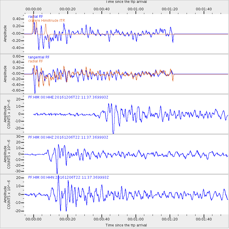
HIM cratere Himiltrude - Earthquake Result Viewer
*The percent match for this event was below the threshold and hence no stack was calculated.
| Earthquake location: |
Northern Sumatra, Indonesia |
| Earthquake latitude/longitude: |
5.3/96.1 |
| Earthquake time(UTC): |
2016/12/06 (341) 22:03:32 GMT |
| Earthquake Depth: |
8.2 km |
| Earthquake Magnitude: |
6.5 Mww |
| Earthquake Catalog/Contributor: |
NEIC PDE/us |
|
| Network: |
PF Volcanologic Network of Piton de Fournaise-OVPF |
| Station: |
HIM cratere Himiltrude |
| Lat/Lon: |
21.21 S/55.72 E |
| Elevation: |
1958 m |
|
| Distance: |
47.6 deg |
| Az: |
235.01 deg |
| Baz: |
60.967 deg |
| Ray Param: |
$rayparam |
*The percent match for this event was below the threshold and hence was not used in the summary stack. |
|
| Radial Match: |
62.755287 % |
| Radial Bump: |
366 |
| Transverse Match: |
77.15771 % |
| Transverse Bump: |
400 |
| SOD ConfigId: |
1894071 |
| Insert Time: |
2016-12-20 22:05:52.373 +0000 |
| GWidth: |
2.5 |
| Max Bumps: |
400 |
| Tol: |
0.001 |
|
Signal To Noise
| Channel | StoN | STA | LTA |
| PF:HIM:00:HHZ:20161206T22:11:37.369993Z | 0.8823292 | 5.9197845E-7 | 6.7092697E-7 |
| PF:HIM:00:HHN:20161206T22:11:37.369993Z | 1.4153 | 1.24295E-6 | 8.782237E-7 |
| PF:HIM:00:HHE:20161206T22:11:37.369993Z | 1.0495483 | 7.8283006E-7 | 7.4587336E-7 |
| Arrivals |
| Ps | |
| PpPs | |
| PsPs/PpSs | |


