You are here: Home > Network List > US - United States National Seismic Network Stations List
> Station HAWA Hanford, Washington, USA > Earthquake Result Viewer
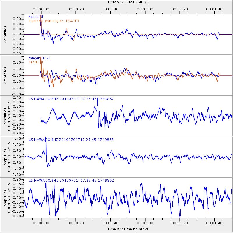
HAWA Hanford, Washington, USA - Earthquake Result Viewer
*The percent match for this event was below the threshold and hence no stack was calculated.
| Earthquake location: |
Vanuatu Islands |
| Earthquake latitude/longitude: |
-15.5/167.5 |
| Earthquake time(UTC): |
2019/07/01 (182) 17:13:29 GMT |
| Earthquake Depth: |
100 km |
| Earthquake Magnitude: |
6.0 Mww |
| Earthquake Catalog/Contributor: |
NEIC PDE/us |
|
| Network: |
US United States National Seismic Network |
| Station: |
HAWA Hanford, Washington, USA |
| Lat/Lon: |
46.39 N/119.53 W |
| Elevation: |
364 m |
|
| Distance: |
89.7 deg |
| Az: |
41.432 deg |
| Baz: |
247.205 deg |
| Ray Param: |
$rayparam |
*The percent match for this event was below the threshold and hence was not used in the summary stack. |
|
| Radial Match: |
65.28742 % |
| Radial Bump: |
400 |
| Transverse Match: |
55.581944 % |
| Transverse Bump: |
400 |
| SOD ConfigId: |
18369291 |
| Insert Time: |
2019-07-15 17:21:32.671 +0000 |
| GWidth: |
2.5 |
| Max Bumps: |
400 |
| Tol: |
0.001 |
|
Signal To Noise
| Channel | StoN | STA | LTA |
| US:HAWA:00:BHZ:20190701T17:25:45.174986Z | 8.613658 | 5.8427474E-7 | 6.7831195E-8 |
| US:HAWA:00:BH1:20190701T17:25:45.174986Z | 1.3916466 | 8.1736125E-8 | 5.873339E-8 |
| US:HAWA:00:BH2:20190701T17:25:45.174986Z | 2.122424 | 1.8915212E-7 | 8.9120796E-8 |
| Arrivals |
| Ps | |
| PpPs | |
| PsPs/PpSs | |


