You are here: Home > Network List > UW - Pacific Northwest Regional Seismic Network Stations List
> Station LEBA Lebam, WA, USA > Earthquake Result Viewer
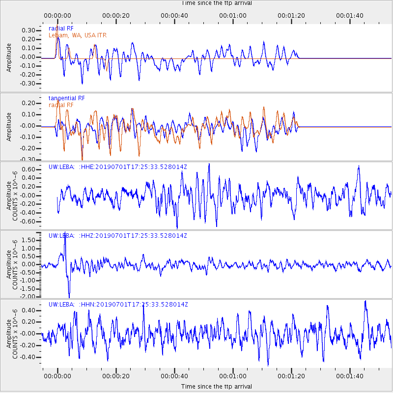
LEBA Lebam, WA, USA - Earthquake Result Viewer
*The percent match for this event was below the threshold and hence no stack was calculated.
| Earthquake location: |
Vanuatu Islands |
| Earthquake latitude/longitude: |
-15.5/167.5 |
| Earthquake time(UTC): |
2019/07/01 (182) 17:13:29 GMT |
| Earthquake Depth: |
100 km |
| Earthquake Magnitude: |
6.0 Mww |
| Earthquake Catalog/Contributor: |
NEIC PDE/us |
|
| Network: |
UW Pacific Northwest Regional Seismic Network |
| Station: |
LEBA Lebam, WA, USA |
| Lat/Lon: |
46.55 N/123.56 W |
| Elevation: |
73 m |
|
| Distance: |
87.3 deg |
| Az: |
40.147 deg |
| Baz: |
244.258 deg |
| Ray Param: |
$rayparam |
*The percent match for this event was below the threshold and hence was not used in the summary stack. |
|
| Radial Match: |
69.66287 % |
| Radial Bump: |
400 |
| Transverse Match: |
61.948807 % |
| Transverse Bump: |
400 |
| SOD ConfigId: |
18369291 |
| Insert Time: |
2019-07-15 17:22:06.711 +0000 |
| GWidth: |
2.5 |
| Max Bumps: |
400 |
| Tol: |
0.001 |
|
Signal To Noise
| Channel | StoN | STA | LTA |
| UW:LEBA: :HHZ:20190701T17:25:33.528014Z | 11.418969 | 8.6062886E-7 | 7.536835E-8 |
| UW:LEBA: :HHN:20190701T17:25:33.528014Z | 1.1945952 | 1.3022026E-7 | 1.0900785E-7 |
| UW:LEBA: :HHE:20190701T17:25:33.528014Z | 1.5787343 | 2.1822187E-7 | 1.3822584E-7 |
| Arrivals |
| Ps | |
| PpPs | |
| PsPs/PpSs | |


