You are here: Home > Network List > AV - Alaska Volcano Observatory Stations List
> Station MAPS Pakushin Southeast, Makushin Volcano, Alaska > Earthquake Result Viewer
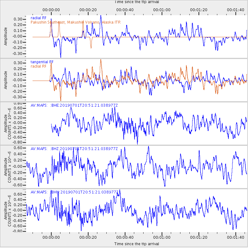
MAPS Pakushin Southeast, Makushin Volcano, Alaska - Earthquake Result Viewer
*The percent match for this event was below the threshold and hence no stack was calculated.
| Earthquake location: |
Banda Sea |
| Earthquake latitude/longitude: |
-7.4/128.5 |
| Earthquake time(UTC): |
2019/07/01 (182) 20:39:50 GMT |
| Earthquake Depth: |
139 km |
| Earthquake Magnitude: |
5.0 Mww |
| Earthquake Catalog/Contributor: |
NEIC PDE/us |
|
| Network: |
AV Alaska Volcano Observatory |
| Station: |
MAPS Pakushin Southeast, Makushin Volcano, Alaska |
| Lat/Lon: |
53.81 N/166.94 W |
| Elevation: |
333 m |
|
| Distance: |
81.4 deg |
| Az: |
32.805 deg |
| Baz: |
244.957 deg |
| Ray Param: |
$rayparam |
*The percent match for this event was below the threshold and hence was not used in the summary stack. |
|
| Radial Match: |
64.12949 % |
| Radial Bump: |
400 |
| Transverse Match: |
57.94561 % |
| Transverse Bump: |
400 |
| SOD ConfigId: |
18369291 |
| Insert Time: |
2019-07-15 20:41:36.692 +0000 |
| GWidth: |
2.5 |
| Max Bumps: |
400 |
| Tol: |
0.001 |
|
Signal To Noise
| Channel | StoN | STA | LTA |
| AV:MAPS: :BHZ:20190701T20:51:21.038977Z | 0.9810146 | 2.067085E-7 | 2.1070889E-7 |
| AV:MAPS: :BHN:20190701T20:51:21.038977Z | 2.1258738 | 3.988012E-7 | 1.8759403E-7 |
| AV:MAPS: :BHE:20190701T20:51:21.038977Z | 1.2404987 | 3.2784803E-7 | 2.6428728E-7 |
| Arrivals |
| Ps | |
| PpPs | |
| PsPs/PpSs | |


