P09A Austin, NV, USA - Earthquake Result Viewer
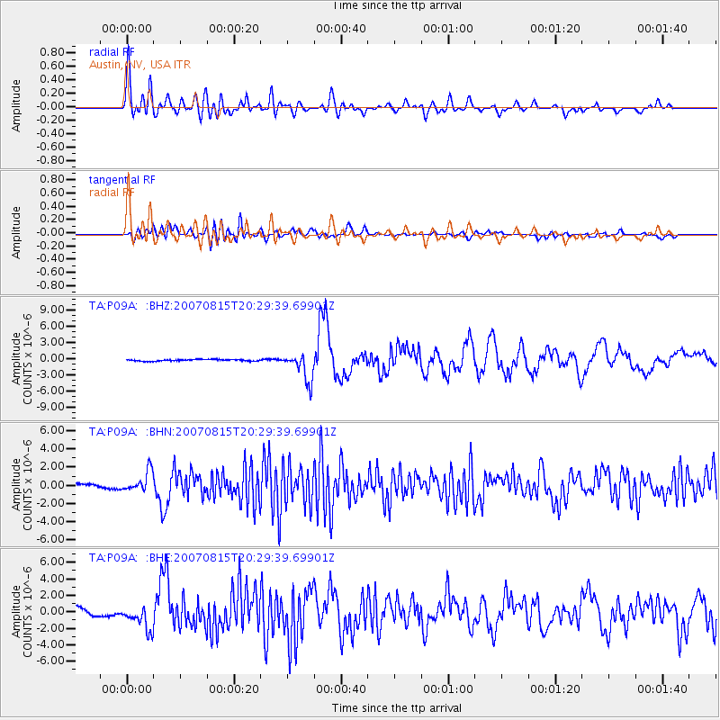
Earthquake location: Andreanof Islands, Aleutian Is.
Earthquake latitude/longitude: 50.3/-177.5
Earthquake time(UTC): 2007/08/15 (227) 20:22:11 GMT
Earthquake Depth: 9.0 km
Earthquake Magnitude: 6.3 MB, 6.2 MS, 6.4 MW, 5.9 ML
Earthquake Catalog/Contributor: WHDF/NEIC
Network: TA USArray Transportable Network (new EarthScope stations)
Station: P09A Austin, NV, USA
Lat/Lon: 39.55 N/117.14 W
Elevation: 1738 m
Distance: 43.0 deg
Az: 80.417 deg
Baz: 305.162 deg
Ray Param: 0.072843924
Estimated Moho Depth: 36.75 km
Estimated Crust Vp/Vs: 1.72
Assumed Crust Vp: 6.276 km/s
Estimated Crust Vs: 3.649 km/s
Estimated Crust Poisson's Ratio: 0.24
Radial Match: 81.656876 %
Radial Bump: 400
Transverse Match: 69.21448 %
Transverse Bump: 400
SOD ConfigId: 2564
Insert Time: 2010-03-07 00:56:45.095 +0000
GWidth: 2.5
Max Bumps: 400
Tol: 0.001

Signal To Noise

ChannelStoNSTALTA
TA:P09A: :BHN:20070815T20:29:39.69901Z5.33460761.1538026E-62.1628631E-7
TA:P09A: :BHE:20070815T20:29:39.69901Z2.52304581.4821153E-65.87431E-7
TA:P09A: :BHZ:20070815T20:29:39.69901Z18.1004662.6353657E-61.4559657E-7
Arrivals
Ps4.5 SECOND
PpPs15 SECOND
PsPs/PpSs19 SECOND