P09A Austin, NV, USA - Earthquake Result Viewer
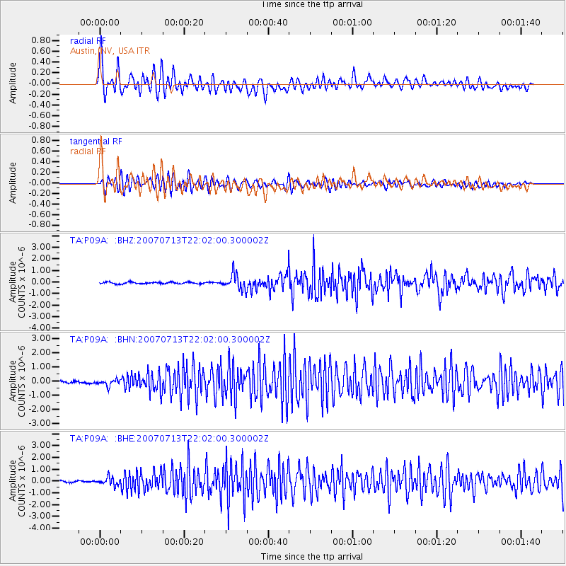
Earthquake location: Andreanof Islands, Aleutian Is.
Earthquake latitude/longitude: 51.8/-176.3
Earthquake time(UTC): 2007/07/13 (194) 21:54:43 GMT
Earthquake Depth: 35 km
Earthquake Magnitude: 5.7 MB, 5.6 MS, 6.0 MW, 5.9 MW
Earthquake Catalog/Contributor: WHDF/NEIC
Network: TA USArray Transportable Network (new EarthScope stations)
Station: P09A Austin, NV, USA
Lat/Lon: 39.55 N/117.14 W
Elevation: 1738 m
Distance: 42.0 deg
Az: 82.914 deg
Baz: 307.215 deg
Ray Param: 0.0733762
Estimated Moho Depth: 24.25 km
Estimated Crust Vp/Vs: 2.08
Assumed Crust Vp: 6.276 km/s
Estimated Crust Vs: 3.024 km/s
Estimated Crust Poisson's Ratio: 0.35
Radial Match: 82.690414 %
Radial Bump: 400
Transverse Match: 79.52522 %
Transverse Bump: 400
SOD ConfigId: 2564
Insert Time: 2010-03-07 00:57:02.718 +0000
GWidth: 2.5
Max Bumps: 400
Tol: 0.001

Signal To Noise

ChannelStoNSTALTA
TA:P09A: :BHN:20070713T22:02:00.300002Z2.17170022.2067725E-71.01614965E-7
TA:P09A: :BHE:20070713T22:02:00.300002Z4.4133913.3179143E-77.517835E-8
TA:P09A: :BHZ:20070713T22:02:00.300002Z9.70667656.749601E-76.953565E-8
Arrivals
Ps4.4 SECOND
PpPs11 SECOND
PsPs/PpSs16 SECOND