
P09A Austin, NV, USA - Earthquake Result Viewer
| ||||||||||||||||||
| ||||||||||||||||||
| ||||||||||||||||||
|
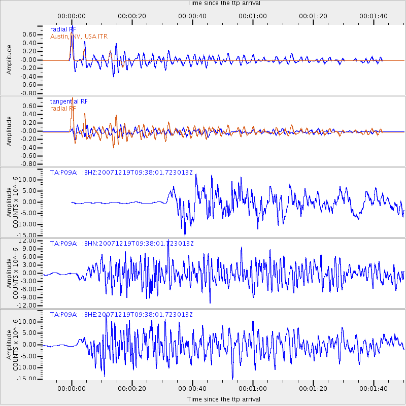
Signal To Noise
| Channel | StoN | STA | LTA |
| TA:P09A: :BHN:20071219T09:38:01.723013Z | 4.2589726 | 1.1825874E-6 | 2.7766967E-7 |
| TA:P09A: :BHE:20071219T09:38:01.723013Z | 6.3029943 | 1.6544702E-6 | 2.6248955E-7 |
| TA:P09A: :BHZ:20071219T09:38:01.723013Z | 13.116995 | 3.0749814E-6 | 2.3442728E-7 |
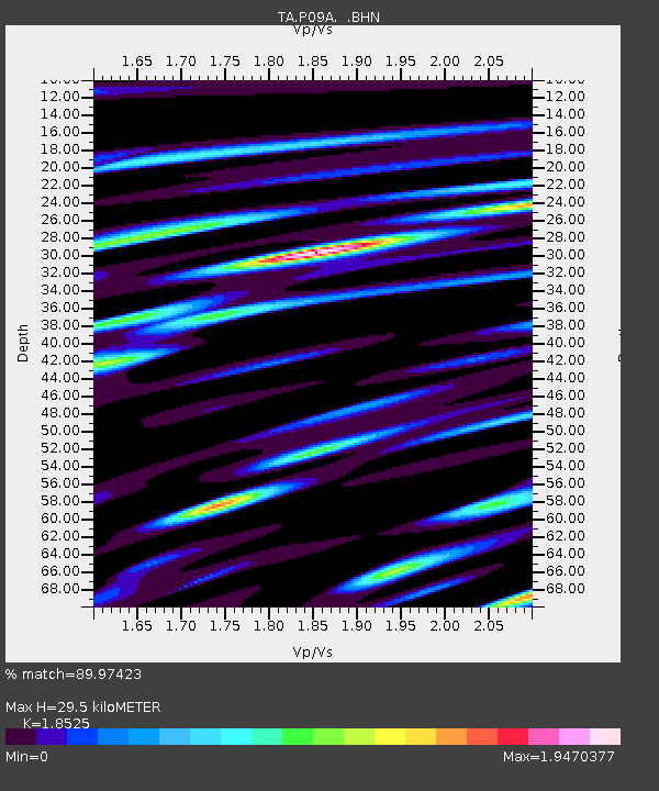
| Arrivals | |
| Ps | 4.3 SECOND |
| PpPs | 13 SECOND |
| PsPs/PpSs | 17 SECOND |

