You are here: Home > Network List > TA - USArray Transportable Network (new EarthScope stations) Stations List
> Station J26L Joseph Creek, AK, USA > Earthquake Result Viewer
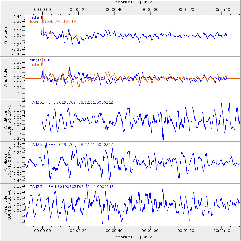
J26L Joseph Creek, AK, USA - Earthquake Result Viewer
*The percent match for this event was below the threshold and hence no stack was calculated.
| Earthquake location: |
Santa Cruz Islands |
| Earthquake latitude/longitude: |
-11.5/166.4 |
| Earthquake time(UTC): |
2019/07/02 (183) 08:00:15 GMT |
| Earthquake Depth: |
54 km |
| Earthquake Magnitude: |
5.6 Mww |
| Earthquake Catalog/Contributor: |
NEIC PDE/us |
|
| Network: |
TA USArray Transportable Network (new EarthScope stations) |
| Station: |
J26L Joseph Creek, AK, USA |
| Lat/Lon: |
64.50 N/143.56 W |
| Elevation: |
1144 m |
|
| Distance: |
84.6 deg |
| Az: |
19.469 deg |
| Baz: |
229.002 deg |
| Ray Param: |
$rayparam |
*The percent match for this event was below the threshold and hence was not used in the summary stack. |
|
| Radial Match: |
79.35093 % |
| Radial Bump: |
400 |
| Transverse Match: |
65.47289 % |
| Transverse Bump: |
400 |
| SOD ConfigId: |
18369291 |
| Insert Time: |
2019-07-16 08:05:21.179 +0000 |
| GWidth: |
2.5 |
| Max Bumps: |
400 |
| Tol: |
0.001 |
|
Signal To Noise
| Channel | StoN | STA | LTA |
| TA:J26L: :BHZ:20190702T08:12:11.600021Z | 4.759633 | 2.2076028E-7 | 4.6381786E-8 |
| TA:J26L: :BHN:20190702T08:12:11.600021Z | 1.3054496 | 4.8095806E-8 | 3.6842334E-8 |
| TA:J26L: :BHE:20190702T08:12:11.600021Z | 0.6920999 | 4.39913E-8 | 6.356206E-8 |
| Arrivals |
| Ps | |
| PpPs | |
| PsPs/PpSs | |


