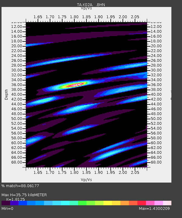
K02A Glendale, OR, USA - Earthquake Result Viewer
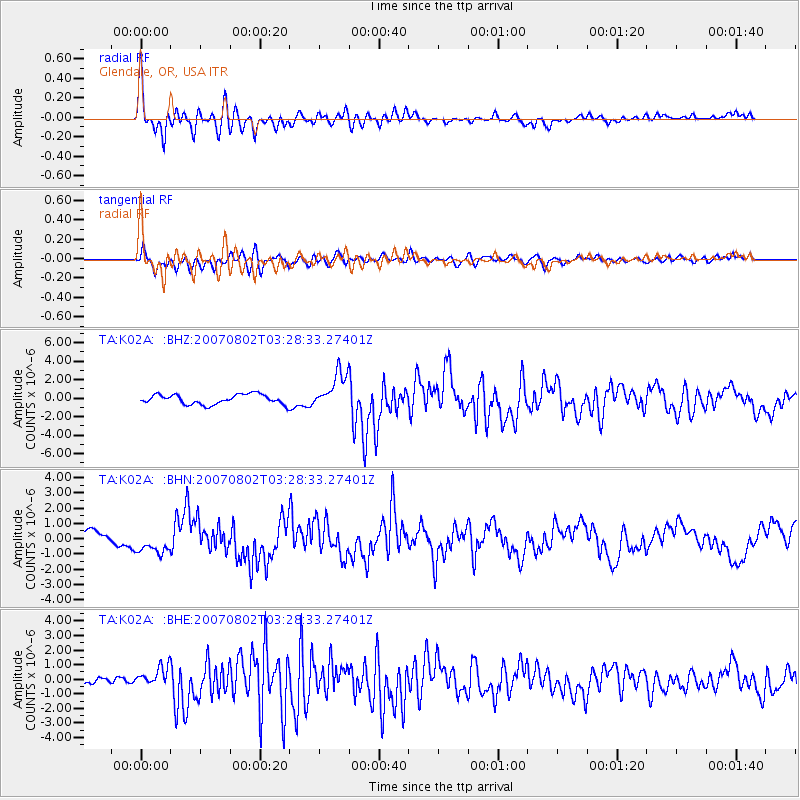
Earthquake location: Andreanof Islands, Aleutian Is.
Earthquake latitude/longitude: 51.3/-180.0
Earthquake time(UTC): 2007/08/02 (214) 03:21:42 GMT
Earthquake Depth: 21 km
Earthquake Magnitude: 6.3 MB, 6.6 MS, 6.7 MW, 6.6 MW
Earthquake Catalog/Contributor: WHDF/NEIC
Network: TA USArray Transportable Network (new EarthScope stations)
Station: K02A Glendale, OR, USA
Lat/Lon: 42.77 N/123.49 W
Elevation: 963 m
Distance: 38.6 deg
Az: 80.012 deg
Baz: 302.914 deg
Ray Param: 0.07546096
Estimated Moho Depth: 35.75 km
Estimated Crust Vp/Vs: 1.81
Assumed Crust Vp: 6.522 km/s
Estimated Crust Vs: 3.598 km/s
Estimated Crust Poisson's Ratio: 0.28
Radial Match: 88.06177 %
Radial Bump: 400
Transverse Match: 75.59339 %
Transverse Bump: 400
SOD ConfigId: 2564
Insert Time: 2010-03-07 00:58:54.623 +0000
GWidth: 2.5
Max Bumps: 400
Tol: 0.001

Signal To Noise

ChannelStoNSTALTA
TA:K02A: :BHN:20070802T03:28:33.27401Z1.75023097.35365E-74.2015316E-7
TA:K02A: :BHE:20070802T03:28:33.27401Z3.18437746.728029E-72.1128241E-7
TA:K02A: :BHZ:20070802T03:28:33.27401Z3.72172451.9641916E-65.2776386E-7
Arrivals
Ps4.8 SECOND
PpPs14 SECOND
PsPs/PpSs19 SECOND