
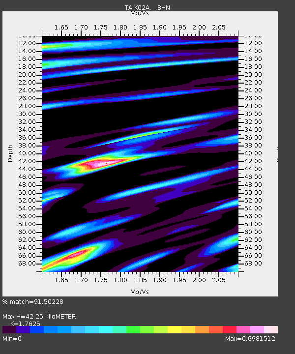
K02A Glendale, OR, USA - Earthquake Result Viewer
| ||||||||||||||||||
| ||||||||||||||||||
| ||||||||||||||||||
|
Signal To Noise
| Channel | StoN | STA | LTA |
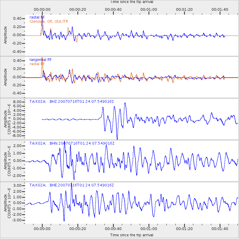
| TA:K02A: :BHN:20070716T01:24:07.549016Z | 5.904289 | 4.620473E-7 | 7.8256214E-8 |
| TA:K02A: :BHE:20070716T01:24:07.549016Z | 6.205035 | 7.383104E-7 | 1.1898569E-7 |
| TA:K02A: :BHZ:20070716T01:24:07.549016Z | 11.575843 | 1.9983916E-6 | 1.7263464E-7 |
| Arrivals | |
| Ps | 5.1 SECOND |
| PpPs | 17 SECOND |
| PsPs/PpSs | 22 SECOND |

