
K02A Glendale, OR, USA - Earthquake Result Viewer
| ||||||||||||||||||
| ||||||||||||||||||
| ||||||||||||||||||
|
Signal To Noise
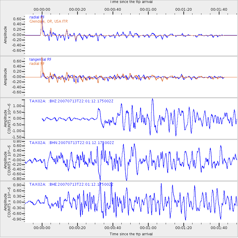
| Channel | StoN | STA | LTA |
| TA:K02A: :BHN:20070713T22:01:12.175002Z | 2.9600594 | 1.928012E-7 | 6.513423E-8 |
| TA:K02A: :BHE:20070713T22:01:12.175002Z | 3.2196712 | 1.7984642E-7 | 5.5858628E-8 |
| TA:K02A: :BHZ:20070713T22:01:12.175002Z | 6.127083 | 4.420519E-7 | 7.214721E-8 |
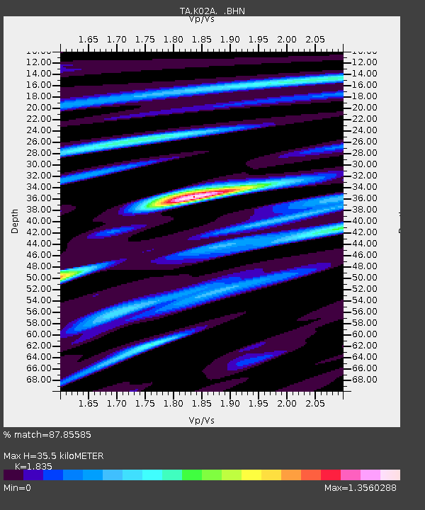
| Arrivals | |
| Ps | 4.9 SECOND |
| PpPs | 14 SECOND |
| PsPs/PpSs | 19 SECOND |

