
K02A Glendale, OR, USA - Earthquake Result Viewer
| ||||||||||||||||||
| ||||||||||||||||||
| ||||||||||||||||||
|
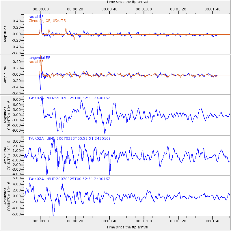
Signal To Noise
| Channel | StoN | STA | LTA |
| TA:K02A: :BHN:20070325T00:52:51.249016Z | 1.7918311 | 1.6504889E-6 | 9.2111856E-7 |
| TA:K02A: :BHE:20070325T00:52:51.249016Z | 0.5880401 | 1.3514956E-6 | 2.2983052E-6 |
| TA:K02A: :BHZ:20070325T00:52:51.249016Z | 0.81604934 | 3.656147E-6 | 4.4803014E-6 |
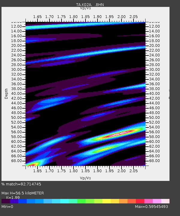
| Arrivals | |
| Ps | 8.9 SECOND |
| PpPs | 25 SECOND |
| PsPs/PpSs | 34 SECOND |

