You are here: Home > Network List > TA - USArray Transportable Network (new EarthScope stations) Stations List
> Station D23K Nanushuk River, AK USA > Earthquake Result Viewer
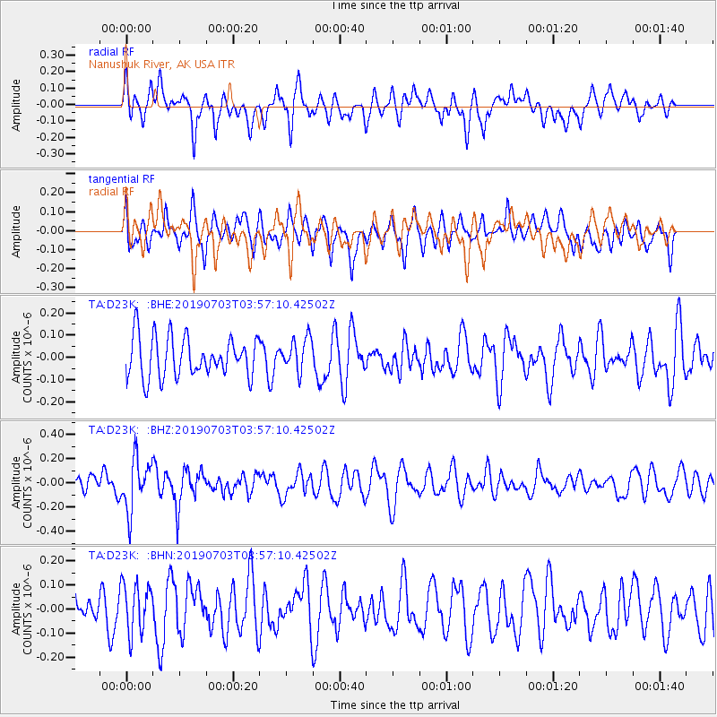
D23K Nanushuk River, AK USA - Earthquake Result Viewer
*The percent match for this event was below the threshold and hence no stack was calculated.
| Earthquake location: |
South Of Fiji Islands |
| Earthquake latitude/longitude: |
-22.2/-179.5 |
| Earthquake time(UTC): |
2019/07/03 (184) 03:45:28 GMT |
| Earthquake Depth: |
574 km |
| Earthquake Magnitude: |
5.8 Mww |
| Earthquake Catalog/Contributor: |
NEIC PDE/us |
|
| Network: |
TA USArray Transportable Network (new EarthScope stations) |
| Station: |
D23K Nanushuk River, AK USA |
| Lat/Lon: |
68.97 N/150.68 W |
| Elevation: |
406 m |
|
| Distance: |
93.3 deg |
| Az: |
10.039 deg |
| Baz: |
206.585 deg |
| Ray Param: |
$rayparam |
*The percent match for this event was below the threshold and hence was not used in the summary stack. |
|
| Radial Match: |
53.988396 % |
| Radial Bump: |
400 |
| Transverse Match: |
56.81451 % |
| Transverse Bump: |
400 |
| SOD ConfigId: |
19053131 |
| Insert Time: |
2019-07-17 03:51:48.630 +0000 |
| GWidth: |
2.5 |
| Max Bumps: |
400 |
| Tol: |
0.001 |
|
Signal To Noise
| Channel | StoN | STA | LTA |
| TA:D23K: :BHZ:20190703T03:57:10.42502Z | 2.0678856 | 2.1278824E-7 | 1.0290136E-7 |
| TA:D23K: :BHN:20190703T03:57:10.42502Z | 1.3907498 | 1.0245062E-7 | 7.3665746E-8 |
| TA:D23K: :BHE:20190703T03:57:10.42502Z | 0.83837974 | 7.5419976E-8 | 8.995921E-8 |
| Arrivals |
| Ps | |
| PpPs | |
| PsPs/PpSs | |


