You are here: Home > Network List > TA - USArray Transportable Network (new EarthScope stations) Stations List
> Station I30M Mount Dempster, Yukon, CAN > Earthquake Result Viewer
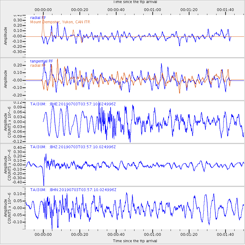
I30M Mount Dempster, Yukon, CAN - Earthquake Result Viewer
*The percent match for this event was below the threshold and hence no stack was calculated.
| Earthquake location: |
South Of Fiji Islands |
| Earthquake latitude/longitude: |
-22.2/-179.5 |
| Earthquake time(UTC): |
2019/07/03 (184) 03:45:28 GMT |
| Earthquake Depth: |
574 km |
| Earthquake Magnitude: |
5.8 Mww |
| Earthquake Catalog/Contributor: |
NEIC PDE/us |
|
| Network: |
TA USArray Transportable Network (new EarthScope stations) |
| Station: |
I30M Mount Dempster, Yukon, CAN |
| Lat/Lon: |
65.22 N/136.38 W |
| Elevation: |
1399 m |
|
| Distance: |
93.2 deg |
| Az: |
16.769 deg |
| Baz: |
219.388 deg |
| Ray Param: |
$rayparam |
*The percent match for this event was below the threshold and hence was not used in the summary stack. |
|
| Radial Match: |
46.189598 % |
| Radial Bump: |
391 |
| Transverse Match: |
69.1407 % |
| Transverse Bump: |
400 |
| SOD ConfigId: |
19053131 |
| Insert Time: |
2019-07-17 03:52:12.517 +0000 |
| GWidth: |
2.5 |
| Max Bumps: |
400 |
| Tol: |
0.001 |
|
Signal To Noise
| Channel | StoN | STA | LTA |
| TA:I30M: :BHZ:20190703T03:57:10.024996Z | 2.525973 | 1.4807117E-7 | 5.8619452E-8 |
| TA:I30M: :BHN:20190703T03:57:10.024996Z | 1.2317159 | 5.2271886E-8 | 4.2438263E-8 |
| TA:I30M: :BHE:20190703T03:57:10.024996Z | 0.85840243 | 4.8388603E-8 | 5.637053E-8 |
| Arrivals |
| Ps | |
| PpPs | |
| PsPs/PpSs | |


