You are here: Home > Network List > TA - USArray Transportable Network (new EarthScope stations) Stations List
> Station R33M Jennings River, BC, CAN > Earthquake Result Viewer
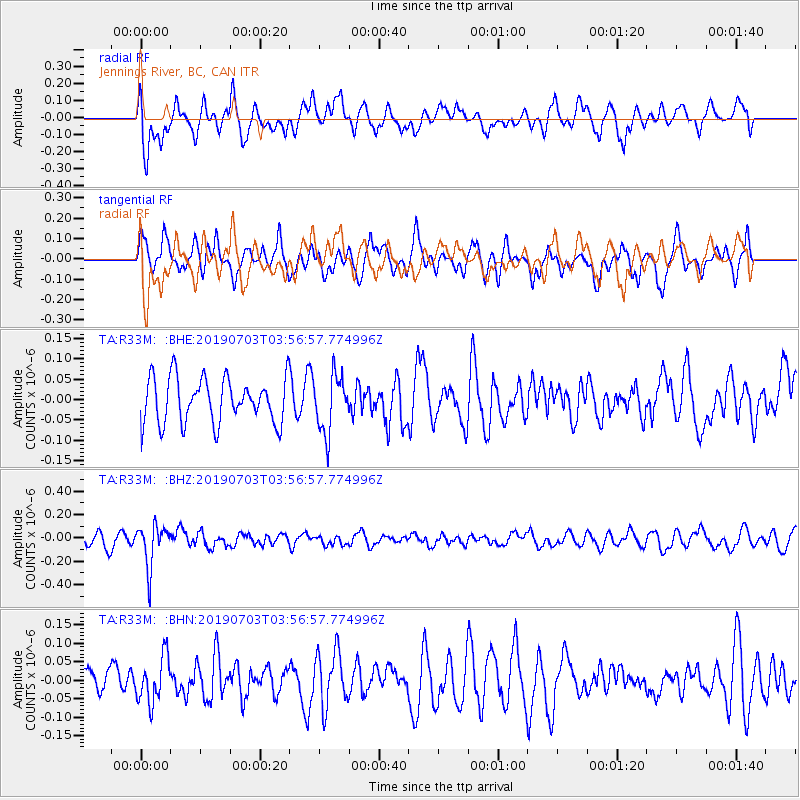
R33M Jennings River, BC, CAN - Earthquake Result Viewer
*The percent match for this event was below the threshold and hence no stack was calculated.
| Earthquake location: |
South Of Fiji Islands |
| Earthquake latitude/longitude: |
-22.2/-179.5 |
| Earthquake time(UTC): |
2019/07/03 (184) 03:45:28 GMT |
| Earthquake Depth: |
574 km |
| Earthquake Magnitude: |
5.8 Mww |
| Earthquake Catalog/Contributor: |
NEIC PDE/us |
|
| Network: |
TA USArray Transportable Network (new EarthScope stations) |
| Station: |
R33M Jennings River, BC, CAN |
| Lat/Lon: |
59.39 N/130.97 W |
| Elevation: |
1437 m |
|
| Distance: |
90.5 deg |
| Az: |
22.545 deg |
| Baz: |
223.995 deg |
| Ray Param: |
$rayparam |
*The percent match for this event was below the threshold and hence was not used in the summary stack. |
|
| Radial Match: |
53.73321 % |
| Radial Bump: |
400 |
| Transverse Match: |
49.85581 % |
| Transverse Bump: |
393 |
| SOD ConfigId: |
19053131 |
| Insert Time: |
2019-07-17 03:52:54.270 +0000 |
| GWidth: |
2.5 |
| Max Bumps: |
400 |
| Tol: |
0.001 |
|
Signal To Noise
| Channel | StoN | STA | LTA |
| TA:R33M: :BHZ:20190703T03:56:57.774996Z | 2.1082008 | 1.7839139E-7 | 8.461784E-8 |
| TA:R33M: :BHN:20190703T03:56:57.774996Z | 1.5993661 | 6.145997E-8 | 3.8427707E-8 |
| TA:R33M: :BHE:20190703T03:56:57.774996Z | 1.2567508 | 6.976901E-8 | 5.551539E-8 |
| Arrivals |
| Ps | |
| PpPs | |
| PsPs/PpSs | |


