You are here: Home > Network List > UW - Pacific Northwest Regional Seismic Network Stations List
> Station LEBA Lebam, WA, USA > Earthquake Result Viewer
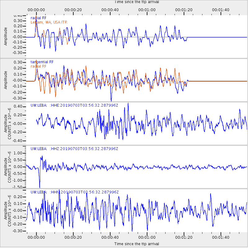
LEBA Lebam, WA, USA - Earthquake Result Viewer
*The percent match for this event was below the threshold and hence no stack was calculated.
| Earthquake location: |
South Of Fiji Islands |
| Earthquake latitude/longitude: |
-22.2/-179.5 |
| Earthquake time(UTC): |
2019/07/03 (184) 03:45:28 GMT |
| Earthquake Depth: |
574 km |
| Earthquake Magnitude: |
5.8 Mww |
| Earthquake Catalog/Contributor: |
NEIC PDE/us |
|
| Network: |
UW Pacific Northwest Regional Seismic Network |
| Station: |
LEBA Lebam, WA, USA |
| Lat/Lon: |
46.55 N/123.56 W |
| Elevation: |
73 m |
|
| Distance: |
85.0 deg |
| Az: |
35.025 deg |
| Baz: |
230.424 deg |
| Ray Param: |
$rayparam |
*The percent match for this event was below the threshold and hence was not used in the summary stack. |
|
| Radial Match: |
61.238148 % |
| Radial Bump: |
400 |
| Transverse Match: |
63.13768 % |
| Transverse Bump: |
400 |
| SOD ConfigId: |
19053131 |
| Insert Time: |
2019-07-17 03:54:07.741 +0000 |
| GWidth: |
2.5 |
| Max Bumps: |
400 |
| Tol: |
0.001 |
|
Signal To Noise
| Channel | StoN | STA | LTA |
| UW:LEBA: :HHZ:20190703T03:56:32.287996Z | 6.0551267 | 4.942788E-7 | 8.1629814E-8 |
| UW:LEBA: :HHN:20190703T03:56:32.287996Z | 1.6820737 | 1.12992744E-7 | 6.7174675E-8 |
| UW:LEBA: :HHE:20190703T03:56:32.287996Z | 1.491026 | 1.4250224E-7 | 9.557328E-8 |
| Arrivals |
| Ps | |
| PpPs | |
| PsPs/PpSs | |


