You are here: Home > Network List > TA - USArray Transportable Network (new EarthScope stations) Stations List
> Station O07A Toulon, NV, USA > Earthquake Result Viewer
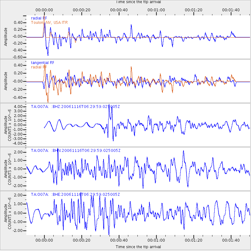
O07A Toulon, NV, USA - Earthquake Result Viewer

| Earthquake location: |
East Of Kuril Islands |
| Earthquake latitude/longitude: |
46.4/154.5 |
| Earthquake time(UTC): |
2006/11/16 (320) 06:20:20 GMT |
| Earthquake Depth: |
9.0 km |
| Earthquake Magnitude: |
6.0 MB, 5.4 MS, 5.9 MW, 5.9 MW |
| Earthquake Catalog/Contributor: |
WHDF/NEIC |
|
| Network: |
TA USArray Transportable Network (new EarthScope stations) |
| Station: |
O07A Toulon, NV, USA |
| Lat/Lon: |
40.16 N/118.88 W |
| Elevation: |
1203 m |
|
| Distance: |
60.4 deg |
| Az: |
61.658 deg |
| Baz: |
307.308 deg |
| Ray Param: |
0.061578598 |
| Estimated Moho Depth: |
33.5 km |
| Estimated Crust Vp/Vs: |
1.62 |
| Assumed Crust Vp: |
6.276 km/s |
| Estimated Crust Vs: |
3.862 km/s |
| Estimated Crust Poisson's Ratio: |
0.20 |
|
| Radial Match: |
82.401375 % |
| Radial Bump: |
400 |
| Transverse Match: |
56.446598 % |
| Transverse Bump: |
400 |
| SOD ConfigId: |
2564 |
| Insert Time: |
2010-03-07 01:06:45.484 +0000 |
| GWidth: |
2.5 |
| Max Bumps: |
400 |
| Tol: |
0.001 |
|
Signal To Noise
| Channel | StoN | STA | LTA |
| TA:O07A: :BHN:20061116T06:29:59.025005Z | 1.0060579 | 3.8698923E-7 | 3.8465902E-7 |
| TA:O07A: :BHE:20061116T06:29:59.025005Z | 0.19857323 | 1.6425865E-7 | 8.2719436E-7 |
| TA:O07A: :BHZ:20061116T06:29:59.025005Z | 2.4965432 | 1.3740099E-6 | 5.50365E-7 |
| Arrivals |
| Ps | 3.5 SECOND |
| PpPs | 13 SECOND |
| PsPs/PpSs | 17 SECOND |


