You are here: Home > Network List > TA - USArray Transportable Network (new EarthScope stations) Stations List
> Station O07A Toulon, NV, USA > Earthquake Result Viewer
O07A Toulon, NV, USA - Earthquake Result Viewer

| Earthquake location: |
Fiji Islands Region |
| Earthquake latitude/longitude: |
-16.5/177.0 |
| Earthquake time(UTC): |
2006/04/07 (097) 08:30:45 GMT |
| Earthquake Depth: |
22 km |
| Earthquake Magnitude: |
5.9 MB, 6.4 MS, 6.4 MW, 6.4 MW |
| Earthquake Catalog/Contributor: |
WHDF/NEIC |
|
| Network: |
TA USArray Transportable Network (new EarthScope stations) |
| Station: |
O07A Toulon, NV, USA |
| Lat/Lon: |
40.16 N/118.88 W |
| Elevation: |
1203 m |
|
| Distance: |
82.0 deg |
| Az: |
44.137 deg |
| Baz: |
240.641 deg |
| Ray Param: |
0.04715621 |
| Estimated Moho Depth: |
32.25 km |
| Estimated Crust Vp/Vs: |
1.69 |
| Assumed Crust Vp: |
6.276 km/s |
| Estimated Crust Vs: |
3.719 km/s |
| Estimated Crust Poisson's Ratio: |
0.23 |
|
| Radial Match: |
90.74195 % |
| Radial Bump: |
400 |
| Transverse Match: |
82.53706 % |
| Transverse Bump: |
400 |
| SOD ConfigId: |
2669 |
| Insert Time: |
2010-03-07 01:07:40.189 +0000 |
| GWidth: |
2.5 |
| Max Bumps: |
400 |
| Tol: |
0.001 |
|
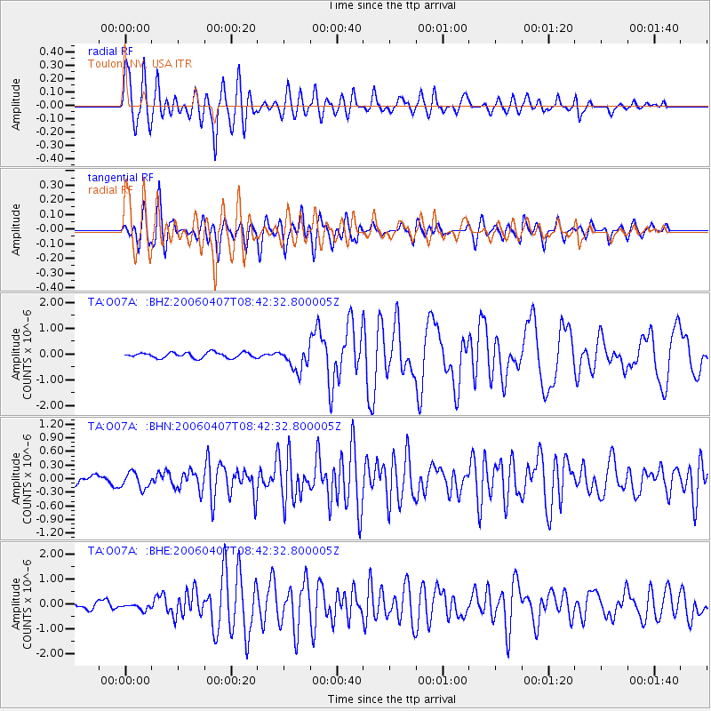
Signal To Noise
| Channel | StoN | STA | LTA |
| TA:O07A: :BHN:20060407T08:42:32.800005Z | 1.6589786 | 1.7464211E-7 | 1.0527087E-7 |
| TA:O07A: :BHE:20060407T08:42:32.800005Z | 0.7031623 | 1.2664803E-7 | 1.8011208E-7 |
| TA:O07A: :BHZ:20060407T08:42:32.800005Z | 4.330293 | 4.4803357E-7 | 1.03464956E-7 |
| Arrivals |
| Ps | 3.6 SECOND |
| PpPs | 13 SECOND |
| PsPs/PpSs | 17 SECOND |


