
O06A Flanigan, NV, USA - Earthquake Result Viewer
| ||||||||||||||||||
| ||||||||||||||||||
| ||||||||||||||||||
|
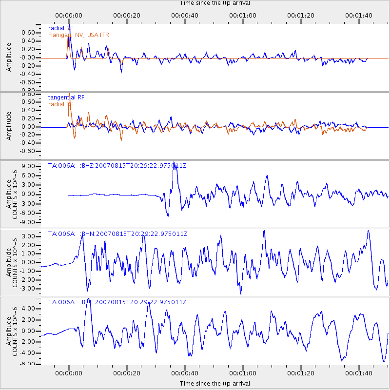
Signal To Noise
| Channel | StoN | STA | LTA |
| TA:O06A: :BHN:20070815T20:29:22.975011Z | 4.189581 | 1.3258604E-6 | 3.164661E-7 |
| TA:O06A: :BHE:20070815T20:29:22.975011Z | 1.9374939 | 1.0242782E-6 | 5.2866136E-7 |
| TA:O06A: :BHZ:20070815T20:29:22.975011Z | 17.320839 | 2.7937915E-6 | 1.6129654E-7 |
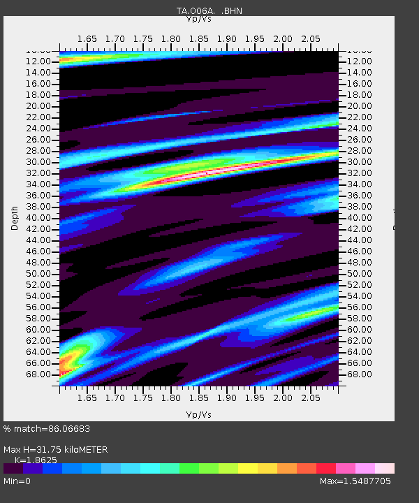
| Arrivals | |
| Ps | 4.6 SECOND |
| PpPs | 14 SECOND |
| PsPs/PpSs | 18 SECOND |

