O06A Flanigan, NV, USA - Earthquake Result Viewer
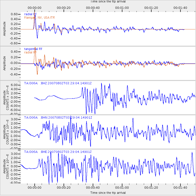
Earthquake location: Andreanof Islands, Aleutian Is.
Earthquake latitude/longitude: 51.3/-180.0
Earthquake time(UTC): 2007/08/02 (214) 03:21:42 GMT
Earthquake Depth: 21 km
Earthquake Magnitude: 6.3 MB, 6.6 MS, 6.7 MW, 6.6 MW
Earthquake Catalog/Contributor: WHDF/NEIC
Network: TA USArray Transportable Network (new EarthScope stations)
Station: O06A Flanigan, NV, USA
Lat/Lon: 40.17 N/119.83 W
Elevation: 1229 m
Distance: 42.3 deg
Az: 80.913 deg
Baz: 306.018 deg
Ray Param: 0.07322486
Estimated Moho Depth: 49.75 km
Estimated Crust Vp/Vs: 1.83
Assumed Crust Vp: 6.276 km/s
Estimated Crust Vs: 3.429 km/s
Estimated Crust Poisson's Ratio: 0.29
Radial Match: 88.1897 %
Radial Bump: 400
Transverse Match: 77.076614 %
Transverse Bump: 400
SOD ConfigId: 2564
Insert Time: 2010-03-07 01:13:43.874 +0000
GWidth: 2.5
Max Bumps: 400
Tol: 0.001

Signal To Noise

ChannelStoNSTALTA
TA:O06A: :BHN:20070802T03:29:04.14901Z2.54795178.749423E-73.4339047E-7
TA:O06A: :BHE:20070802T03:29:04.14901Z1.74778387.160544E-74.0969277E-7
TA:O06A: :BHZ:20070802T03:29:04.14901Z3.52090222.3443351E-66.658336E-7
Arrivals
Ps7.0 SECOND
PpPs21 SECOND
PsPs/PpSs28 SECOND