
O06A Flanigan, NV, USA - Earthquake Result Viewer
| ||||||||||||||||||
| ||||||||||||||||||
| ||||||||||||||||||
|
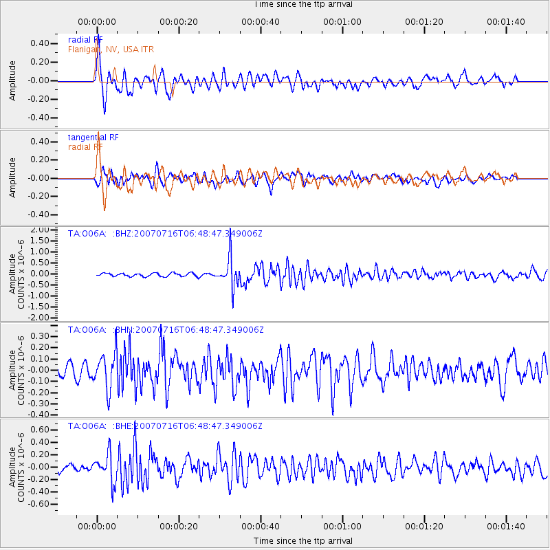
Signal To Noise
| Channel | StoN | STA | LTA |
| TA:O06A: :BHN:20070716T06:48:47.349006Z | 3.7518935 | 1.6617186E-7 | 4.429013E-8 |
| TA:O06A: :BHE:20070716T06:48:47.349006Z | 4.2446465 | 2.360646E-7 | 5.5614663E-8 |
| TA:O06A: :BHZ:20070716T06:48:47.349006Z | 9.088699 | 6.7496507E-7 | 7.426421E-8 |
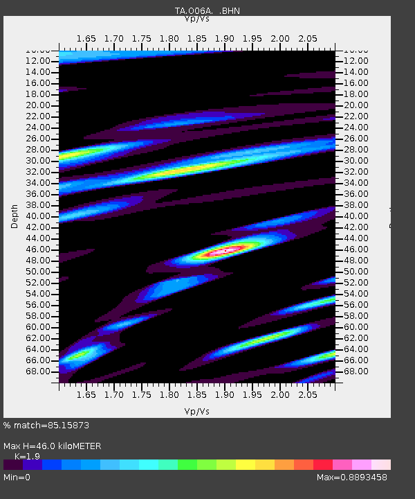
| Arrivals | |
| Ps | 6.8 SECOND |
| PpPs | 21 SECOND |
| PsPs/PpSs | 27 SECOND |

