
O06A Flanigan, NV, USA - Earthquake Result Viewer
| ||||||||||||||||||
| ||||||||||||||||||
| ||||||||||||||||||
|
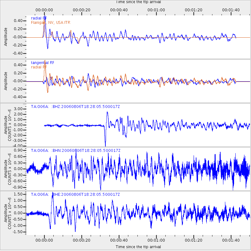
Signal To Noise
| Channel | StoN | STA | LTA |
| TA:O06A: :BHN:20060806T18:28:05.500017Z | 3.013429 | 2.9390648E-7 | 9.7532244E-8 |
| TA:O06A: :BHE:20060806T18:28:05.500017Z | 6.614637 | 6.5914367E-7 | 9.964926E-8 |
| TA:O06A: :BHZ:20060806T18:28:05.500017Z | 16.443472 | 1.3837474E-6 | 8.4151786E-8 |
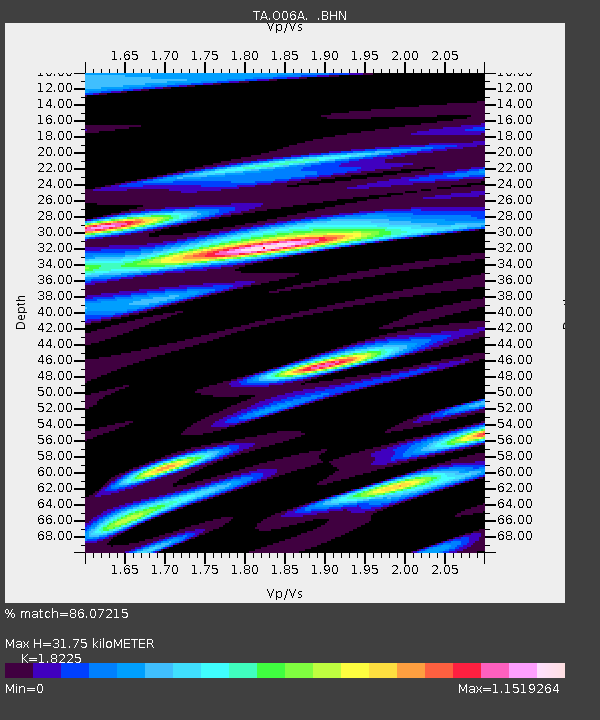
| Arrivals | |
| Ps | 4.3 SECOND |
| PpPs | 14 SECOND |
| PsPs/PpSs | 18 SECOND |

