
O06A Flanigan, NV, USA - Earthquake Result Viewer
| ||||||||||||||||||
| ||||||||||||||||||
| ||||||||||||||||||
|
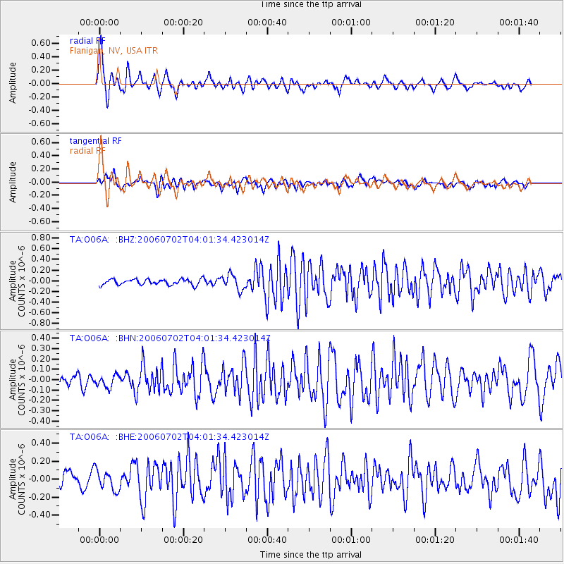
Signal To Noise
| Channel | StoN | STA | LTA |
| TA:O06A: :BHN:20060702T04:01:34.423014Z | 1.0282911 | 5.7471773E-8 | 5.5890563E-8 |
| TA:O06A: :BHE:20060702T04:01:34.423014Z | 1.5015156 | 1.0357921E-7 | 6.8983105E-8 |
| TA:O06A: :BHZ:20060702T04:01:34.423014Z | 2.8112636 | 1.459126E-7 | 5.1902852E-8 |
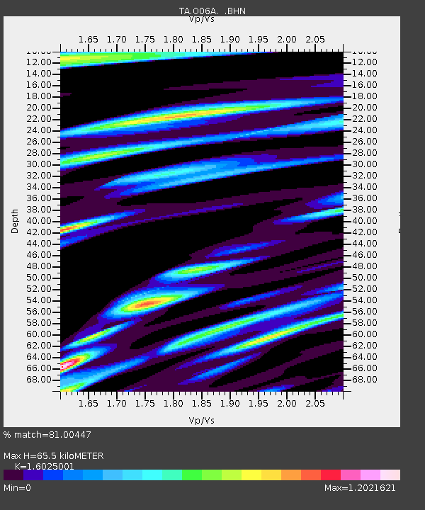
| Arrivals | |
| Ps | 6.7 SECOND |
| PpPs | 25 SECOND |
| PsPs/PpSs | 32 SECOND |

