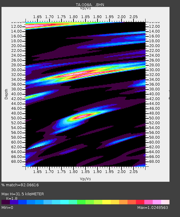
O06A Flanigan, NV, USA - Earthquake Result Viewer
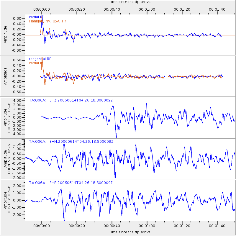
Earthquake location: Rat Islands, Aleutian Islands
Earthquake latitude/longitude: 51.8/177.1
Earthquake time(UTC): 2006/06/14 (165) 04:18:42 GMT
Earthquake Depth: 14 km
Earthquake Magnitude: 5.9 MB, 6.4 MS, 6.4 MW, 6.4 MW
Earthquake Catalog/Contributor: WHDF/NEIC
Network: TA USArray Transportable Network (new EarthScope stations)
Station: O06A Flanigan, NV, USA
Lat/Lon: 40.17 N/119.83 W
Elevation: 1229 m
Distance: 44.0 deg
Az: 79.415 deg
Baz: 307.119 deg
Ray Param: 0.07215057
Estimated Moho Depth: 31.5 km
Estimated Crust Vp/Vs: 1.80
Assumed Crust Vp: 6.276 km/s
Estimated Crust Vs: 3.487 km/s
Estimated Crust Poisson's Ratio: 0.28
Radial Match: 92.06616 %
Radial Bump: 400
Transverse Match: 76.33278 %
Transverse Bump: 400
SOD ConfigId: 5745
Insert Time: 2010-03-07 01:14:57.877 +0000
GWidth: 2.5
Max Bumps: 400
Tol: 0.001

Signal To Noise

ChannelStoNSTALTA
TA:O06A: :BHN:20060614T04:26:18.800009Z2.23636482.8832434E-71.2892545E-7
TA:O06A: :BHE:20060614T04:26:18.800009Z2.3413992.922323E-71.24811E-7
TA:O06A: :BHZ:20060614T04:26:18.800009Z3.2356225.822285E-71.7994331E-7
Arrivals
Ps4.3 SECOND
PpPs13 SECOND
PsPs/PpSs17 SECOND