You are here: Home > Network List > UW - Pacific Northwest Regional Seismic Network Stations List
> Station LEBA Lebam, WA, USA > Earthquake Result Viewer
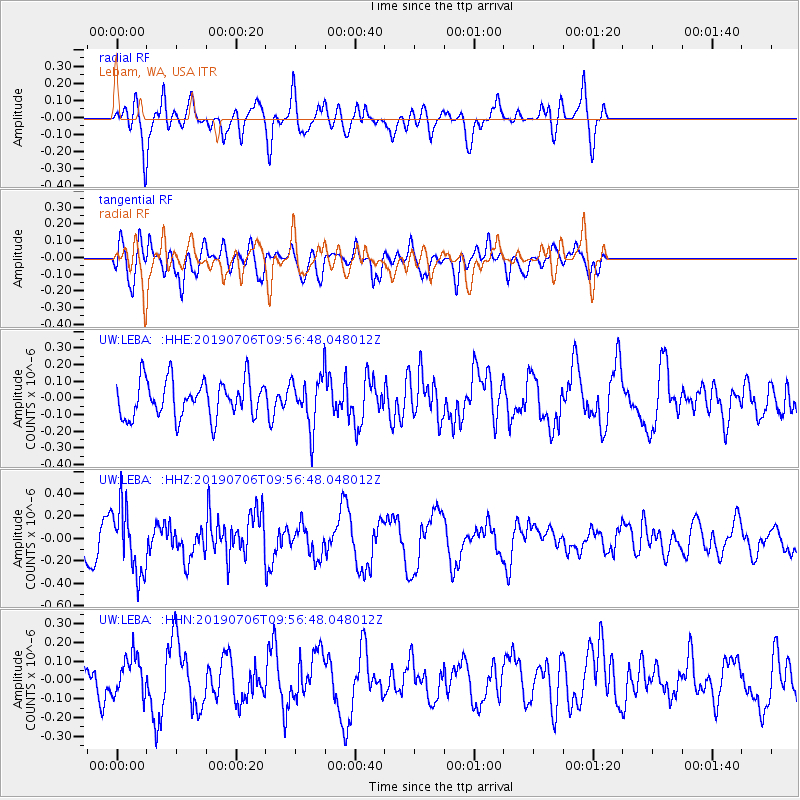
LEBA Lebam, WA, USA - Earthquake Result Viewer
*The percent match for this event was below the threshold and hence no stack was calculated.
| Earthquake location: |
Solomon Islands |
| Earthquake latitude/longitude: |
-6.3/154.7 |
| Earthquake time(UTC): |
2019/07/06 (187) 09:44:29 GMT |
| Earthquake Depth: |
43 km |
| Earthquake Magnitude: |
5.5 Mww |
| Earthquake Catalog/Contributor: |
NEIC PDE/us |
|
| Network: |
UW Pacific Northwest Regional Seismic Network |
| Station: |
LEBA Lebam, WA, USA |
| Lat/Lon: |
46.55 N/123.56 W |
| Elevation: |
73 m |
|
| Distance: |
88.8 deg |
| Az: |
43.09 deg |
| Baz: |
259.719 deg |
| Ray Param: |
$rayparam |
*The percent match for this event was below the threshold and hence was not used in the summary stack. |
|
| Radial Match: |
65.15814 % |
| Radial Bump: |
400 |
| Transverse Match: |
61.811 % |
| Transverse Bump: |
400 |
| SOD ConfigId: |
19053131 |
| Insert Time: |
2019-07-20 09:52:43.993 +0000 |
| GWidth: |
2.5 |
| Max Bumps: |
400 |
| Tol: |
0.001 |
|
Signal To Noise
| Channel | StoN | STA | LTA |
| UW:LEBA: :HHZ:20190706T09:56:48.048012Z | 1.7223206 | 2.9427656E-7 | 1.708605E-7 |
| UW:LEBA: :HHN:20190706T09:56:48.048012Z | 0.8193125 | 1.06927395E-7 | 1.3050868E-7 |
| UW:LEBA: :HHE:20190706T09:56:48.048012Z | 1.3254737 | 1.466856E-7 | 1.1066654E-7 |
| Arrivals |
| Ps | |
| PpPs | |
| PsPs/PpSs | |


