You are here: Home > Network List > TA - USArray Transportable Network (new EarthScope stations) Stations List
> Station J06A Christmas Valley, OR, USA > Earthquake Result Viewer
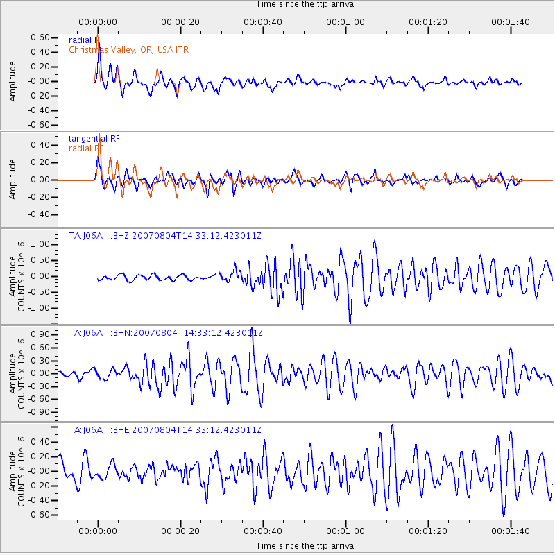
J06A Christmas Valley, OR, USA - Earthquake Result Viewer

| Earthquake location: |
Central East Pacific Rise |
| Earthquake latitude/longitude: |
-4.8/-105.4 |
| Earthquake time(UTC): |
2007/08/04 (216) 14:24:51 GMT |
| Earthquake Depth: |
10 km |
| Earthquake Magnitude: |
5.7 MS, 5.4 MB, 6.0 MW, 5.9 MW |
| Earthquake Catalog/Contributor: |
WHDF/NEIC |
|
| Network: |
TA USArray Transportable Network (new EarthScope stations) |
| Station: |
J06A Christmas Valley, OR, USA |
| Lat/Lon: |
43.25 N/120.15 W |
| Elevation: |
1407 m |
|
| Distance: |
49.7 deg |
| Az: |
345.875 deg |
| Baz: |
160.559 deg |
| Ray Param: |
0.06856391 |
| Estimated Moho Depth: |
21.75 km |
| Estimated Crust Vp/Vs: |
1.91 |
| Assumed Crust Vp: |
6.597 km/s |
| Estimated Crust Vs: |
3.454 km/s |
| Estimated Crust Poisson's Ratio: |
0.31 |
|
| Radial Match: |
82.50727 % |
| Radial Bump: |
385 |
| Transverse Match: |
78.41828 % |
| Transverse Bump: |
400 |
| SOD ConfigId: |
2564 |
| Insert Time: |
2010-03-07 01:16:04.403 +0000 |
| GWidth: |
2.5 |
| Max Bumps: |
400 |
| Tol: |
0.001 |
|
Signal To Noise
| Channel | StoN | STA | LTA |
| TA:J06A: :BHN:20070804T14:33:12.423011Z | 1.2908947 | 1.046344E-7 | 8.105572E-8 |
| TA:J06A: :BHE:20070804T14:33:12.423011Z | 1.2116909 | 9.337124E-8 | 7.705863E-8 |
| TA:J06A: :BHZ:20070804T14:33:12.423011Z | 2.217312 | 1.6981534E-7 | 7.658612E-8 |
| Arrivals |
| Ps | 3.2 SECOND |
| PpPs | 9.1 SECOND |
| PsPs/PpSs | 12 SECOND |


