J06A Christmas Valley, OR, USA - Earthquake Result Viewer
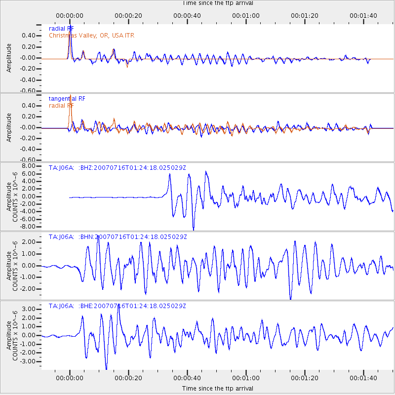
Earthquake location: Near West Coast Of Honshu, Japan
Earthquake latitude/longitude: 37.5/138.4
Earthquake time(UTC): 2007/07/16 (197) 01:13:22 GMT
Earthquake Depth: 12 km
Earthquake Magnitude: 6.5 MB, 6.4 MS, 6.6 MW, 6.5 MW
Earthquake Catalog/Contributor: WHDF/NEIC
Network: TA USArray Transportable Network (new EarthScope stations)
Station: J06A Christmas Valley, OR, USA
Lat/Lon: 43.25 N/120.15 W
Elevation: 1407 m
Distance: 72.6 deg
Az: 48.648 deg
Baz: 305.241 deg
Ray Param: 0.053563803
Estimated Moho Depth: 37.25 km
Estimated Crust Vp/Vs: 1.80
Assumed Crust Vp: 6.597 km/s
Estimated Crust Vs: 3.67 km/s
Estimated Crust Poisson's Ratio: 0.28
Radial Match: 93.505066 %
Radial Bump: 400
Transverse Match: 85.95497 %
Transverse Bump: 400
SOD ConfigId: 2564
Insert Time: 2010-03-07 01:16:15.273 +0000
GWidth: 2.5
Max Bumps: 400
Tol: 0.001

Signal To Noise

ChannelStoNSTALTA
TA:J06A: :BHN:20070716T01:24:18.025029Z11.50896555.34121E-74.640912E-8
TA:J06A: :BHE:20070716T01:24:18.025029Z15.3339788.141932E-75.3097324E-8
TA:J06A: :BHZ:20070716T01:24:18.025029Z46.9571152.0747211E-64.4183317E-8
Arrivals
Ps4.7 SECOND
PpPs15 SECOND
PsPs/PpSs20 SECOND