You are here: Home > Network List > US - United States National Seismic Network Stations List
> Station MNTX Cornudas Mountains, Texas, USA > Earthquake Result Viewer
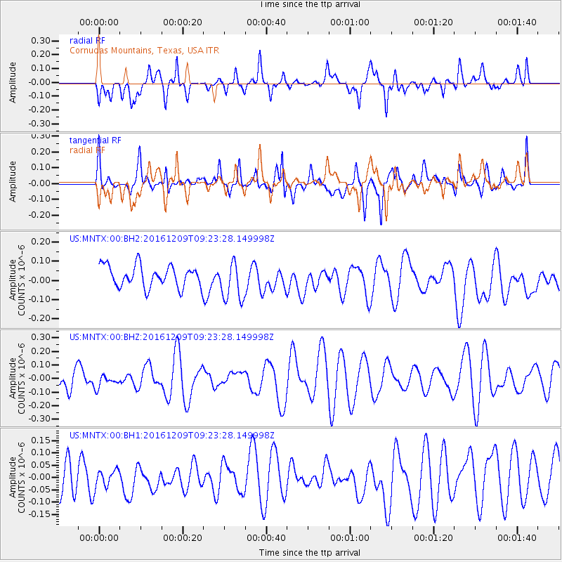
MNTX Cornudas Mountains, Texas, USA - Earthquake Result Viewer
*The percent match for this event was below the threshold and hence no stack was calculated.
| Earthquake location: |
Solomon Islands |
| Earthquake latitude/longitude: |
-10.7/161.5 |
| Earthquake time(UTC): |
2016/12/09 (344) 09:10:26 GMT |
| Earthquake Depth: |
42 km |
| Earthquake Magnitude: |
5.5 mb |
| Earthquake Catalog/Contributor: |
NEIC PDE/us |
|
| Network: |
US United States National Seismic Network |
| Station: |
MNTX Cornudas Mountains, Texas, USA |
| Lat/Lon: |
31.70 N/105.38 W |
| Elevation: |
404 m |
|
| Distance: |
98.2 deg |
| Az: |
59.311 deg |
| Baz: |
262.479 deg |
| Ray Param: |
$rayparam |
*The percent match for this event was below the threshold and hence was not used in the summary stack. |
|
| Radial Match: |
57.02303 % |
| Radial Bump: |
400 |
| Transverse Match: |
54.507145 % |
| Transverse Bump: |
400 |
| SOD ConfigId: |
1894071 |
| Insert Time: |
2016-12-23 09:12:15.204 +0000 |
| GWidth: |
2.5 |
| Max Bumps: |
400 |
| Tol: |
0.001 |
|
Signal To Noise
| Channel | StoN | STA | LTA |
| US:MNTX:00:BHZ:20161209T09:23:28.149998Z | 0.4070954 | 4.6588394E-8 | 1.14440965E-7 |
| US:MNTX:00:BH1:20161209T09:23:28.149998Z | 0.35114413 | 3.078073E-8 | 8.7658385E-8 |
| US:MNTX:00:BH2:20161209T09:23:28.149998Z | 1.8560433 | 1.0365974E-7 | 5.5849846E-8 |
| Arrivals |
| Ps | |
| PpPs | |
| PsPs/PpSs | |


