You are here: Home > Network List > TA - USArray Transportable Network (new EarthScope stations) Stations List
> Station B18K Kokolik River, AK, USA > Earthquake Result Viewer
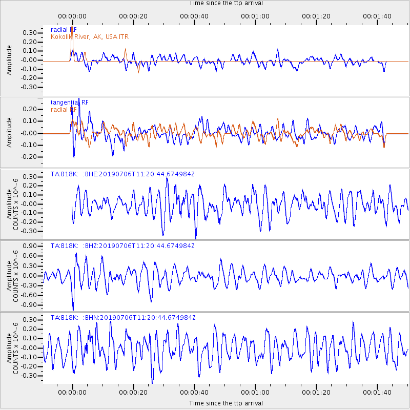
B18K Kokolik River, AK, USA - Earthquake Result Viewer
*The percent match for this event was below the threshold and hence no stack was calculated.
| Earthquake location: |
Vanuatu Islands |
| Earthquake latitude/longitude: |
-21.0/169.8 |
| Earthquake time(UTC): |
2019/07/06 (187) 11:08:16 GMT |
| Earthquake Depth: |
99 km |
| Earthquake Magnitude: |
5.6 Mww |
| Earthquake Catalog/Contributor: |
NEIC PDE/us |
|
| Network: |
TA USArray Transportable Network (new EarthScope stations) |
| Station: |
B18K Kokolik River, AK, USA |
| Lat/Lon: |
69.36 N/161.80 W |
| Elevation: |
222 m |
|
| Distance: |
92.4 deg |
| Az: |
9.713 deg |
| Baz: |
206.406 deg |
| Ray Param: |
$rayparam |
*The percent match for this event was below the threshold and hence was not used in the summary stack. |
|
| Radial Match: |
41.94567 % |
| Radial Bump: |
400 |
| Transverse Match: |
69.81177 % |
| Transverse Bump: |
400 |
| SOD ConfigId: |
19053131 |
| Insert Time: |
2019-07-20 11:14:10.787 +0000 |
| GWidth: |
2.5 |
| Max Bumps: |
400 |
| Tol: |
0.001 |
|
Signal To Noise
| Channel | StoN | STA | LTA |
| TA:B18K: :BHZ:20190706T11:20:44.674984Z | 3.6755986 | 4.5598716E-7 | 1.2405793E-7 |
| TA:B18K: :BHN:20190706T11:20:44.674984Z | 1.6121051 | 1.547943E-7 | 9.6019974E-8 |
| TA:B18K: :BHE:20190706T11:20:44.674984Z | 2.1727016 | 1.825161E-7 | 8.400422E-8 |
| Arrivals |
| Ps | |
| PpPs | |
| PsPs/PpSs | |


