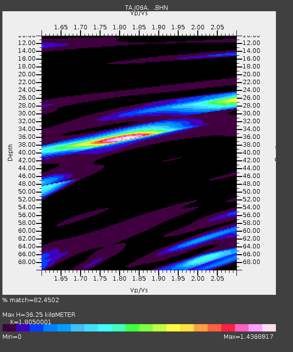
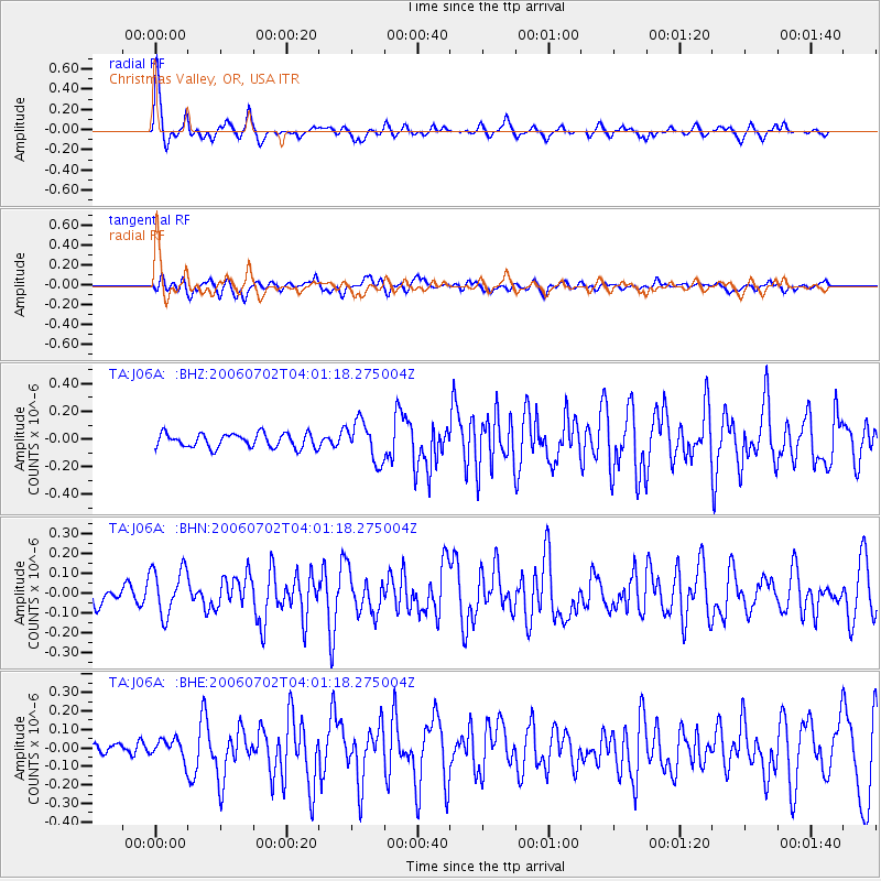
J06A Christmas Valley, OR, USA - Earthquake Result Viewer

Earthquake location: Rat Islands, Aleutian Islands
Earthquake latitude/longitude: 51.7/176.9
Earthquake time(UTC): 2006/07/02 (183) 03:53:56 GMT
Earthquake Depth: 8.6 km
Earthquake Magnitude: 5.5 MB, 5.3 MS, 5.8 MW, 5.7 MW
Earthquake Catalog/Contributor: WHDF/NEIC
Network: TA USArray Transportable Network (new EarthScope stations)
Station: J06A Christmas Valley, OR, USA
Lat/Lon: 43.25 N/120.15 W
Elevation: 1407 m
Distance: 42.1 deg
Az: 75.82 deg
Baz: 304.352 deg
Ray Param: 0.07334817
Estimated Moho Depth: 36.25 km
Estimated Crust Vp/Vs: 1.81
Assumed Crust Vp: 6.597 km/s
Estimated Crust Vs: 3.655 km/s
Estimated Crust Poisson's Ratio: 0.28
Radial Match: 82.4502 %
Radial Bump: 312
Transverse Match: 56.38116 %
Transverse Bump: 400
SOD ConfigId: 2665
Insert Time: 2010-03-07 01:16:56.803 +0000
GWidth: 2.5
Max Bumps: 400
Tol: 0.001

Signal To Noise

ChannelStoNSTALTA
TA:J06A: :BHN:20060702T04:01:18.275004Z2.74231431.2029834E-74.3867452E-8
TA:J06A: :BHE:20060702T04:01:18.275004Z0.85451115.346623E-86.2569384E-8
TA:J06A: :BHZ:20060702T04:01:18.275004Z2.79912521.4233169E-75.0848634E-8
Arrivals
Ps4.7 SECOND
PpPs14 SECOND
PsPs/PpSs19 SECOND