You are here: Home > Network List > TA - USArray Transportable Network (new EarthScope stations) Stations List
> Station R33M Jennings River, BC, CAN > Earthquake Result Viewer
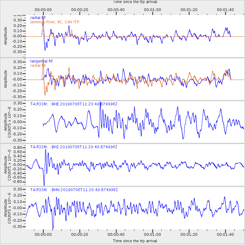
R33M Jennings River, BC, CAN - Earthquake Result Viewer
*The percent match for this event was below the threshold and hence no stack was calculated.
| Earthquake location: |
Vanuatu Islands |
| Earthquake latitude/longitude: |
-21.0/169.8 |
| Earthquake time(UTC): |
2019/07/06 (187) 11:08:16 GMT |
| Earthquake Depth: |
99 km |
| Earthquake Magnitude: |
5.6 Mww |
| Earthquake Catalog/Contributor: |
NEIC PDE/us |
|
| Network: |
TA USArray Transportable Network (new EarthScope stations) |
| Station: |
R33M Jennings River, BC, CAN |
| Lat/Lon: |
59.39 N/130.97 W |
| Elevation: |
1437 m |
|
| Distance: |
93.5 deg |
| Az: |
26.132 deg |
| Baz: |
233.554 deg |
| Ray Param: |
$rayparam |
*The percent match for this event was below the threshold and hence was not used in the summary stack. |
|
| Radial Match: |
71.928894 % |
| Radial Bump: |
367 |
| Transverse Match: |
60.91393 % |
| Transverse Bump: |
400 |
| SOD ConfigId: |
19053131 |
| Insert Time: |
2019-07-20 11:15:50.755 +0000 |
| GWidth: |
2.5 |
| Max Bumps: |
400 |
| Tol: |
0.001 |
|
Signal To Noise
| Channel | StoN | STA | LTA |
| TA:R33M: :BHZ:20190706T11:20:49.874996Z | 3.568884 | 4.15579E-7 | 1.16445094E-7 |
| TA:R33M: :BHN:20190706T11:20:49.874996Z | 0.89529216 | 7.575727E-8 | 8.4617376E-8 |
| TA:R33M: :BHE:20190706T11:20:49.874996Z | 2.0979567 | 1.396703E-7 | 6.6574444E-8 |
| Arrivals |
| Ps | |
| PpPs | |
| PsPs/PpSs | |


