You are here: Home > Network List > US - United States National Seismic Network Stations List
> Station HAWA Hanford, Washington, USA > Earthquake Result Viewer
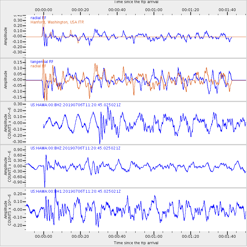
HAWA Hanford, Washington, USA - Earthquake Result Viewer
*The percent match for this event was below the threshold and hence no stack was calculated.
| Earthquake location: |
Vanuatu Islands |
| Earthquake latitude/longitude: |
-21.0/169.8 |
| Earthquake time(UTC): |
2019/07/06 (187) 11:08:16 GMT |
| Earthquake Depth: |
99 km |
| Earthquake Magnitude: |
5.6 Mww |
| Earthquake Catalog/Contributor: |
NEIC PDE/us |
|
| Network: |
US United States National Seismic Network |
| Station: |
HAWA Hanford, Washington, USA |
| Lat/Lon: |
46.39 N/119.53 W |
| Elevation: |
364 m |
|
| Distance: |
92.4 deg |
| Az: |
40.82 deg |
| Baz: |
241.954 deg |
| Ray Param: |
$rayparam |
*The percent match for this event was below the threshold and hence was not used in the summary stack. |
|
| Radial Match: |
76.26307 % |
| Radial Bump: |
400 |
| Transverse Match: |
54.041996 % |
| Transverse Bump: |
400 |
| SOD ConfigId: |
19053131 |
| Insert Time: |
2019-07-20 11:16:25.848 +0000 |
| GWidth: |
2.5 |
| Max Bumps: |
400 |
| Tol: |
0.001 |
|
Signal To Noise
| Channel | StoN | STA | LTA |
| US:HAWA:00:BHZ:20190706T11:20:45.025021Z | 4.051701 | 3.522692E-7 | 8.694354E-8 |
| US:HAWA:00:BH1:20190706T11:20:45.025021Z | 1.3580438 | 8.040908E-8 | 5.9209494E-8 |
| US:HAWA:00:BH2:20190706T11:20:45.025021Z | 1.6842891 | 1.2914873E-7 | 7.667848E-8 |
| Arrivals |
| Ps | |
| PpPs | |
| PsPs/PpSs | |


