You are here: Home > Network List > UW - Pacific Northwest Regional Seismic Network Stations List
> Station LEBA Lebam, WA, USA > Earthquake Result Viewer
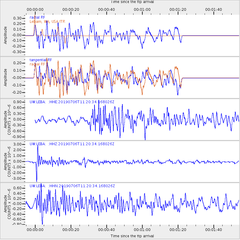
LEBA Lebam, WA, USA - Earthquake Result Viewer
*The percent match for this event was below the threshold and hence no stack was calculated.
| Earthquake location: |
Vanuatu Islands |
| Earthquake latitude/longitude: |
-21.0/169.8 |
| Earthquake time(UTC): |
2019/07/06 (187) 11:08:16 GMT |
| Earthquake Depth: |
99 km |
| Earthquake Magnitude: |
5.6 Mww |
| Earthquake Catalog/Contributor: |
NEIC PDE/us |
|
| Network: |
UW Pacific Northwest Regional Seismic Network |
| Station: |
LEBA Lebam, WA, USA |
| Lat/Lon: |
46.55 N/123.56 W |
| Elevation: |
73 m |
|
| Distance: |
90.1 deg |
| Az: |
39.315 deg |
| Baz: |
239.074 deg |
| Ray Param: |
$rayparam |
*The percent match for this event was below the threshold and hence was not used in the summary stack. |
|
| Radial Match: |
76.19264 % |
| Radial Bump: |
400 |
| Transverse Match: |
63.866093 % |
| Transverse Bump: |
400 |
| SOD ConfigId: |
19053131 |
| Insert Time: |
2019-07-20 11:16:59.470 +0000 |
| GWidth: |
2.5 |
| Max Bumps: |
400 |
| Tol: |
0.001 |
|
Signal To Noise
| Channel | StoN | STA | LTA |
| UW:LEBA: :HHZ:20190706T11:20:34.168026Z | 9.226684 | 1.1167134E-6 | 1.2103085E-7 |
| UW:LEBA: :HHN:20190706T11:20:34.168026Z | 3.4916189 | 3.3696375E-7 | 9.650645E-8 |
| UW:LEBA: :HHE:20190706T11:20:34.168026Z | 2.7879052 | 2.974311E-7 | 1.06686215E-7 |
| Arrivals |
| Ps | |
| PpPs | |
| PsPs/PpSs | |


