You are here: Home > Network List > US - United States National Seismic Network Stations List
> Station MNTX Cornudas Mountains, Texas, USA > Earthquake Result Viewer
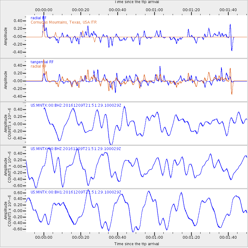
MNTX Cornudas Mountains, Texas, USA - Earthquake Result Viewer
*The percent match for this event was below the threshold and hence no stack was calculated.
| Earthquake location: |
Solomon Islands |
| Earthquake latitude/longitude: |
-10.9/161.4 |
| Earthquake time(UTC): |
2016/12/09 (344) 21:38:23 GMT |
| Earthquake Depth: |
10 km |
| Earthquake Magnitude: |
5.8 Mww |
| Earthquake Catalog/Contributor: |
NEIC PDE/us |
|
| Network: |
US United States National Seismic Network |
| Station: |
MNTX Cornudas Mountains, Texas, USA |
| Lat/Lon: |
31.70 N/105.38 W |
| Elevation: |
404 m |
|
| Distance: |
98.4 deg |
| Az: |
59.338 deg |
| Baz: |
262.344 deg |
| Ray Param: |
$rayparam |
*The percent match for this event was below the threshold and hence was not used in the summary stack. |
|
| Radial Match: |
73.51514 % |
| Radial Bump: |
364 |
| Transverse Match: |
82.61035 % |
| Transverse Bump: |
312 |
| SOD ConfigId: |
1894071 |
| Insert Time: |
2016-12-23 21:45:11.081 +0000 |
| GWidth: |
2.5 |
| Max Bumps: |
400 |
| Tol: |
0.001 |
|
Signal To Noise
| Channel | StoN | STA | LTA |
| US:MNTX:00:BHZ:20161209T21:51:29.100029Z | 0.9921512 | 3.5545153E-7 | 3.5826346E-7 |
| US:MNTX:00:BH1:20161209T21:51:29.100029Z | 1.325682 | 3.092891E-7 | 2.3330563E-7 |
| US:MNTX:00:BH2:20161209T21:51:29.100029Z | 0.83360034 | 2.015765E-7 | 2.4181432E-7 |
| Arrivals |
| Ps | |
| PpPs | |
| PsPs/PpSs | |


